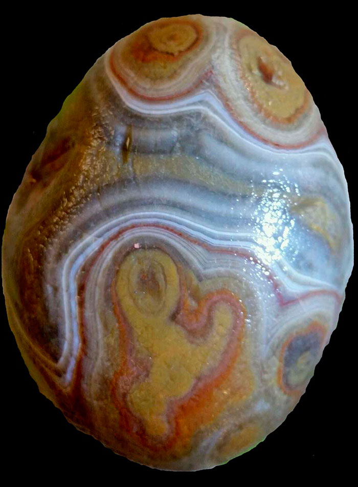
MINERAL OF THE MONTH: December 2017 – Septarian Nodule

Septarian nodules are round concretions found in sedimentary rocks. Concretions are hard solid masses formed by the accumulation of matter within sediment. Although scientists do not agree on the details and specifics of their formation, there are several theories. One proposal suggests they formed when there was dehydration and shrinkage of clay, gel, or organic cores within sedimentary pockets. Others believe there was an expansion of gases produced by the decay of organic matter that fractured material within sedimentary pockets. One more theory is that an earthquake, compaction, or other geologic forces fractured material within sedimentary pockets. However the sedimentary material fractured, mineral-rich fluids filled in the spaces between the fractures allowing calcite, siderite, pyrite, and other minerals to crystalize and fill in the open areas within the cavity.

The most well-known septarian nodules are found in Utah. The Utah septarians developed during the Cretaceous period between 50 and 70 million years ago. At this time the Gulf of Mexico had expanded northwest into the area that is now southern Utah. Scientists believe that volcanic eruptions killed marine organisms, causing them to sink to the bottom of the shallow sea. The decomposing material chemically attracted sediments causing the mixture to form into mud balls. When the ocean receded, the mud balls dried out causing the interior sections to crack and shrink. Over time, mineral-rich solutions infiltrated the cracks causing crystals to form and fill in the cracks. Septarian nodules, sometimes called lightning stones, can also found on the Lake Michigan shoreline as well as in New Zealand, England, Morocco, and Madagascar.

Septarians are composed of calcite (the yellow centers), aragonite (the brown lines), and limestone (the outer grey surface).  Occasionally, fossils can be seen within or on the surface of the nodules.

CITES

CURRENT GRAND MARAIS SCENES: December 2017

NOTE: More Grand Marais scenes are posted often on my blog at www.agatelady.blogspot.com and on my main personal Facebook page listed under Karen Ann Penegor Brzys.

For this webpage update, I have selected some of my favorite pictures that I took in the Grand Marais area between August and November.

To begin here are a couple of fall photos. The first was taken from the Log Slide area looking toward Au Sable Point in the Pictured Rocks National Lakeshore. The second was taken during a hike on the White Birch interpretive trail above Twelve mile Beach Campground.


While at the Twelve Mile Beach Campground I also captured a sunset photo.


On another fall hike in the national park from the Log Slide to the Hurricane River, I captured this picture of the lighthouse.


The photo below was taken on the same hike. It shows the mouth of the Hurricane River looking west. Grand Island, located in Munising Bay, can be seen in the background.


This year we have had more high wind events than you can count. During one storm I drove east of town, hiked to the shoreline, and captured this image.


The third week of October we had some of the largest waves ever recorded on Lake Superior. One wave was 28.8 feet high, as measured at a buoy located north of Munising. As a result, the shoreline erosion was intense. There are sections of the beach that are no longer passable unless you walk in the water. At other points, the driftwood just piled up as can be seen in these two photos taken at First Creek, located just west of Woodland Park in Grand Marais.


We have had a couple of early snowfalls, but as of the end of November, all the snow has melted. Here are a couple of photos I took just after one of the early snowfalls.


History’s Gem of the Month: Article about Seagull (Lost) Island, Grand Marais Bay

December 2017

This morning I went through some of the Gitche Gumee Museum’s archives and came across a newspaper article about the island that used to be on the outside edge of Grand Marais Bay. The island had different names including Seagull Island, Gull Island, and Lost Island.

In the late 1960s my sister and I were the last to walk on the island, which at that time was a narrow spit of sand around 60 feet long. We had rented a canoe from the museum founder, Axel Niemi, and canoed down the old Sucker River to East Bay, carried the canoe across the peninsula by Lonesome Point, and canoed over to the island before returning to the marina. The next day after our canoe ride there was a huge storm. When the waves subsided, the island was no longer. And yes, as the article describes, the seagulls made sure we did not stay on the island very long.

Before getting to the article, here are a series of photos and diagrams of the harbor. This first image shows the harbor configuration in 1870. Although it appears there is a gap allowing access to the bay, the gap was too shallow to allow ships to access the west bay. Then a ship sunk near this gap to further obstruct shipping traffic. Thus, the original settlement of Grand Marais was on East Bay. Eventually the channel was dug on the west side of west bay to allow access to the larger bay.

The photo below from 1897 shows Gull Island. The picture was taken from the end of the peninsula (Coast Guard Point).

The diagram below shows changes to the bay over time.

The photo below was also taken from the end of Coast Guard Point. It was taken sometime during the late 1950s or early 1960s.

NOTE: The article below was cut out of a newspaper, but Axel did not write the date or the name of the newspaper on the clipping.

This Island Really is ‘for the birds’ By Harry C. Sahs

No Matter who holds the deed, gulls “own” the 4.7 acre spit of land the villagers of Grand Marais, Mich., call Gull Island. Thousands of herring seagulls make the island their home, “repelling” visitors with dive-bombing attacks and incessant screams.

Gull Island protects the tiny harbor at Grand Marais from the full fury of Lake Superior. It is adjacent to the rock-bound harbor and breakwater entrance guarded by a U.S. Coast Guard station.

George L. Jacobites of Highland Park, and Edmund Warren, of Miami, Fla., hold the deed, but the gulls hold the land. “It would take a shooting war to force eviction,” said Jacobites. “They’re sticklers for rights,” he said.

Federal law protects the gulls. Harming them could mean a $500 fine, six months in jail or both.

Togetherness is a striking trait of the gulls, who leave the island just ahead of the severest cold and ice and return early in the spring, when Gull Island’s bird population is especially inhospitable to trespassers.

Downy nestlings change their color several times the first year before becoming predominantly white. But one thing they never change is their possessive feeling about gull Island.

It’s their home.

CUSTOMER AGATE FINDS: July 2017

For the second year in a row there was little to no ice flow on Lake Superior. In other years the ice transports rocks around the basin and moves new rocks to our beach, including agates. The ice we did have moved back and forth at the end of spring and did dredge some rocks and sand up the beach. Also, we have had a lot of rain this spring so Lake Superior is within a couple of inches of the all-time monthly high for July, well above the monthly average. Thus, on some beaches the lake level has covered up the rocks. However, on other beaches the waves have pushed the rocks back up the beach. The movement of rocks along the shoreline is in continual motion – so it is always worth treasure hunting in Grand Marais to look for the elusive agate.

I have agate photos of several nice specimens found in the Grand Marais area. First, however, are a few Keweenaw agates found by David Schuder. The first one was hand-chiseled out of a basaltic cliff, the second is from High Rock Bay, and the third is a beautiful copper replacement agate.

The next agate was found last year by Gary Inman. It should have been posted prior to this, but the computer file was missing in action.

The next monster 1.5 pound specimen is a brecciated agate found by Jill Haldeman (Grand Marais). She brought it into the Gitche Gumee Museum on July 19, 2017.

On July 10th Rod Thomas, from Durand, MI, came into the museum with the half pounder shown below. He found the agate in the Grand Marais area.

Tammy, from Muskegon, did not want to be photographed, but the agate she found near the Lake Superior State Forest Campground, which is located a dozen or so miles east of Grand Marais, is worth showing off. This is a nice skip-n-atom agate. She brought the agate into the museum on July 8th.

Another even larger skip-n-atom agate was found by Brenda Van Appel, from Hesperia, MI. She brought it into the museum on July 20th.

MINERAL OF THE MONTH: July 2017 – Kona Dolomite

This rock is named after the Kona Hills, located in Marquette County, Michigan. This is an ancient formation of fossil stromatolite that is between 2.1 and 2.8 billion years old. Most dolomite found throughout the world is gray or white. Kona dolomite is quite colorful and is found nowhere else. Dolomite is a calcium-magnesium carbonate and fizzes in warm acid.  Dolomite is limestone with magnesium added. The Kona formation is dominantly dolomite with interstratified layers of shale, graywacke and quartzite. The dolomite beds are from a few inches to many feet thick, but even the purest beds contain thin cherty layers and other sedimentary clastic material.

The original organisms that created this fossil rock were some of the first life on earth. There was nothing to eat so these early cyanobacteria survived by using the energy of the sun via photosynthesis. Cyanobacteria were responsible for producing the first oxygen on earth as a byproduct of this photosynthetic process. Thus, if it were not for stramatolitic organisms, according to scientists, we would probably not be here.

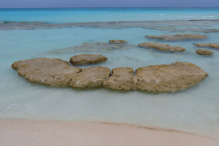
The cyanobacteria grew in shallow water as flat mats to maximize exposure to the sun. The fossil rock formed as the cyanobacteria mats trapped, bound and, and cemented sedimentary grains. Over time, as the trapped sediments blocked the energy of the sun, the cyanobacteria would develop another mat on top of the mound. The mounds grow in various shapes including conical, stratiform layers, branching, and domal.

The earliest stromatolite mounds are believed to be 3.7 billion years old. They peaked around 1.25 billion years ago. Originally scientists believed these species of cyanobacteria were extinct, until live stromatolite mounds were discovered in Sharks Bay, Australia in 1958. Even though 99 percent of all species that have ever existed on earth are extinct – it is amazing that stromatolitic organisms were the first living things on earth – and they are still here. Living stromatolites mounds can be found in Australia, Chili, Brazil, Mexico, Belize, British Columbia and the Yukon (Canada), Minnesota (US), South Africa, and the Bahamas. In modern microbial mats, debris from the surrounding habitat can become trapped within the mucus, which can be cemented together by the calcium carbonate to grow thin laminations of limestone.

Fossilized stromatolite rock can be found throughout the world. Kona dolomite is one example. Because of its tremendously old age, and due to trace minerals, Kona dolomite can be found in a variety of colors including pink, brown, yellow, tan, cream, red, and orange. The colors are often complex with mottling, banding and lacing. The black wavy lines in Kona are the remains of the microbial mats. The unique pink and red pigments are caused by the iron in the soil.

In the rough before polishing the rock does not look nearly as nice – but still cool.

Lapidary enthusiasts enjoy working with this rock because they make beautiful slabs used in crafting clocks, wind chimes, spheres, bookends, cabochons, and other items. Kona is also used for building stones and for making refractory bricks for furnace linings. Due to its vivid coloration it is also used for decorative purposes as crushed stone for borders and walkways.

CITES

NOTE

  • Thanks to Bob and Peg Clark for their donations of Kona dolomite specimens and slabs to the Gitche Gumee Museum.

CURRENT GRAND MARAIS SCENES: July 2017

NOTE: More Grand Marais scenes are posted often on my blog at www.agatelady.blogspot.com and on my main personal Facebook page listed under Karen Ann Penegor Brzys.

For this webpage update, I have selected some of my favorite pictures that I took in the Grand Marais area between the end of March and mid-July.

First, here are a few early spring photos. The first one was taken from the break wall at the end of Coast Guard Point. The second was taken from a bluff in the Grand Sable Dunes.

During late spring when I arrived home, as I drove up my driveway I was greeted by a fawn.

In June we had a lot of rain. One Sunday Grand Marais received five inches. Driveways were washed out, my road was closed due to a sinkhole, other roads were washed out, and the cemetery east of town flooded.

As of mid-July, the level of Lake Superior is 602.89 feet above sea level. This is ten inches above the all-time average for July and only two inches below the all-time recorded high level for the month of July (1950). The current level is 31 inches above the all-time recorded low level for the month (1926). The high water level combined with the increasing number of wind events has caused extreme erosion to the shoreline. East of Grand Marais some of my favorite beaches are no longer accessible since the erosion has formed sand escarpments.

The Grand Marais July 4th celebration was again a great success. The weather cooperated with sun and temperatures in the upper 60s. It was cool enough to allow me to wear the 1800s U.S. Postal Service bear coat and mittens in the parade. The museum founder, Axel Niemi, wore the coat every year, but I only do it when it is cool enough. The firework display was also fantastic!

We have had a lot of great sunsets already this year. In the picture below I used my zoom lens to get a close-up.

I have been doing a better job this summer getting exercise than I have in past summers, but I still do not get out enough. I have gone on several hikes in the Grand Sable Dunes. The following photo was taken from near Sable Lake looking north to the big lake.


In mid-July, I went on a solo hike in the Log Slide area. Unfortunately, the erosion problems took out the platform at the Log Slide. So far the National Park Service has not made repairs. Although the trail to the platform is not open, the North Country trail east and west of the Log Slide is open. The Log Slide itself is also open, but people should take extreme caution going down since there are sections with clay escarpments. The photos below were taken during my Log Slide hike.

CITE

History’s Gem of the Month: Jonas Hill Letters

July 2017

When I researched the history book I wrote two years ago, Superior Land and the Story of Grand Marais, Michigan, one of my tasks was to search through the museum archive and other resources. I have a fourth cousin in Finland (Rauno Sarja) with whom I have been corresponding for several years. Rane found me on the internet due to the posting of a picture of my great-grandfather, Jonas Hill. Jonas was a sibling to Rane’s grandparent. A couple of years ago Rane sent me some letters he found that were written by my great-grandfather. They were written in Finnish, so Rane was kind enough to translate them.

My great-grandfather was born in Finland in 1871 and immigrated to the United States around the turn of last century. He resided in Grand Marais, other than a short time when he lived in Washington State, until his death in 1950. A picture of my great-grandfather and his family is below. Jonas is holding my grandmother. The photo was taken around 1908.

The difficult times livings in Grand Marais during the first few decades of the 1900s are explained in this series of letters between my great-grandfather, Jonas Hill, and our relatives in Finland. The first letter discusses the birth of my grandmother.

Grand Marais, Michigan, December 6, 1907

Well hereby I declare that the incorruptible laws of causes and consequences have increased our family with a daughter on October 18, a grace day in 1909. The name was suggested by a soul better than I — it is Anni Elviira. I hope she will be the beauty of the Promised Land.

Then I found myself to be in bed massaging my bones for three weeks, dead foot fever as they call it. I tried to fix myself, first by means of liquor and pills, which are used in these kinds of health situations. But my pharmaceutical skills were not adequate and I had to rely on medical assistance from a doctor. He willingly gave it proper treatment twice a day for the next week, so I was able to be cured. What a great burden this illness added to my fatherly concerns.

According to recent data there are over 500,000 people unemployed with more lockouts happening every day. Workers must consider if they think with their brains or with their intestines. During our lifetime they care about us very little — only trample and oppress us. Oh well, the situation will not get better by crying. One must open his eyes and start to do something about it.

Grand Marais, Michigan, February 25, 1946

I declare that I live yet, although I am already rotten old at 75 years. I guess nowadays there are only a few people alive who I knew years ago.

It has been difficult here [due to the war] — you need to have a ration card to get what you need. The government is giving me just enough old-age assistance so that I can get my daily bread.

Grand Marais, Michigan, March 5, 1946

My life has been multi-staged and one could write quite a novel about it. Wartime has not been the worst years here. There has been a lot of complaining, but compared to what is happening in other countries complaining here in the U.S. has been almost pointless.

Grand Marais Michigan, April 30, 1946

I thank you for your letter. Receiving it was a moment of joy – the first for me in a long time. I have been in poor health for a few weeks now and couldn’t do much. Old age is causing trouble for me. Also, a lot of younger people have been sick lately, too. It has been an unusually cold spring so far, it is causing troubles for us. This little village has no doctor and it is a bad thing.

The power of money in this country is devilish. The government does not share it with those of us who live in these small villages. Unfortunately, the people here don’t care to put pressure on the authorities. We have only about 100 elders in town now plus the children, but there has not been cooperation in this community for a long time. It is so hard to even get the most basic of goods here nowadays.

So to survive we must take advantage of Mother Nature’s breadbasket and grow what we need during the summer. Because of my age I haven’t been able to work for the last six years. Another issue has been that even if according the law I was entitled to have bread money from the state once I was 65 years old, they delayed giving me that money until I was nearly 68.

Here we have started a collection to send items to Finland. Some used clothes have already been sent. It is tough, though, because now when people are able to earn more money, it seems that the government takes it away. We are taxed so much that you have only empty pockets left. Only those who have no money to begin with have been left in peace. The rich have made a lot of money and now they want to start a new war. I still cannot say if they will succeed but everything is going in that direction.

In my life there have been so many chapters. Now when I’m alone in this cottage my thoughts tend to often return to my homeland in Finland, which I haven’t forgotten. There are no longer many Finns remaining here in Grand Marais as they have all passed away. I’m one of the oldest surviving Finns in town. The younger generation cannot speak Finnish, and they don’t want to learn Finnish — I think this is wrong!

I’m still living and taking care of myself. Although I don’t earn a wage anymore, I try to do something every day. Winter has not been too bad this year, but I am looking forward to the summer breeze when this old pal will hopefully revive a little.

A picture of my great-grandfather’s home is below. The house is located to the west of the Lutheran Church on Brazel Street.

ROCKHOUNDING AND ADVENTURE TRIPS: Colorado – March 2017

In the past most years I drove or flew out to one of the large gem shows such as Tucson, Quartzite, or Denver. These days I typically go every three years, given the time and expense of these trips. This adventure involved 6,125 miles of driving over 26 days. The main two reasons for the trip were to buy gift shop items for the museum at the Tucson Show as well as speaking at the Albuquerque Gem and Mineral Club. In addition, I visited several geologic sites to take photos for possible future books. I went to Palo Duro Canyon State Park (southeast of Amarillo, TX), Carlsbad Caverns, Saguaro National Park, Sedona, the Grand Canyon, and Antelope Canyon. I feel extreme gratitude that I am able to take a trip like this.

CUSTOMER AGATE FINDS: March 2017

Last year was not a great year for agate hunting, mostly due to the lack of ice flow on Lake Superior. It seems that the ice moves rocks around the basin and moves new rocks to our beach, including agates. Unfortunately, ice on Lake Superior is lacking again this year. Since there is almost no ice, evaporation is expected to be much higher so the lake level may be lower this summer. If that is true, there will be more rock exposed, which may help agate hunting. We will see.

For this update I have some agate pictures that people sent to me. First, here are a few Keweenaw agates found by David Schuder.

Carla and Cal from Wisconsin took my agate class in September and then went agate hunting locally as well as on the north shore. They were successful in finding an agate at Beaver Bay, MN!

While I was out west I spoke at the Albuquerque Gem and Mineral Club. I was a member of this club for two winters a decade ago. It was great to see the members again. Also, thanks to the club members for buying books and agates! Sales from this speaking engagement helped pay a lot of my gas for the trip! Several people brought rocks and agates to show me after my talk was completed. After I arrived home, Claudia Johnson also sent some photos of Luna Blue agates, found in western New Mexico. Some of these photos are below. The second and third photos are of the same agate, showing the rough side and then the cut side.

Finally, in November Chris Seidl from Minnesota visited the U.P. He showed me some of his prime Lake Superior agates. These are all BIG!

MINERAL OF THE MONTH: March 2017 – Chert

Chert is a microcrystalline or cryptocrystalline sedimentary rock made mostly of silicon dioxide (SiO2). It can form as nodules, concretions, and as layered deposits. Like other silica rocks and minerals, chert breaks with a conchoidal fracture, often producing very sharp edges. Native Americans took advantage of this fracture pattern and intentionally knapped chert to make arrowheads and other cutting tools and weapons. Since chert forms in sedimentary rock, it often can contain fossils as well as banded layers.

There are two main ways chert forms. In some cases, chert develops when microcrystals of silica grow in deposits of limestone or chalk. This occurs when dissolved silica is transported through sedimentary layers by groundwater. Large numbers of silicon dioxide microcrystals grow from the dissolved silica into irregularly-shaped nodules or concretions. If there is a lot of silica causing large number of nodules to form, the nodules can merge together to develop a contiguous layer of chert within the sedimentary rock. When chert develops from dissolved silica it is classified as a chemical sedimentary rock.

The other way chert forms is from biologic remains. Certain marine organisms contain silica in their exoskeletons or spicules, such as sponges, radiolarian, and diatoms. When these organisms die, their remains fall to the bottom of the oceans or shallow seas. The silica dissolves, recrystallizes, and develops into chert nodules or entire layers of chert.

Most chert is tan, cream color, or gray. When iron impurities are included within the nodules or layers, chert can also be red, green, or black. In some cases red chert, or chert with other colors, is classified as jasper. The term “flint” is used to describe varieties of chert that form in chalk formations, whereas chert usually forms in limestone formations. Some people make a distinction between “flint” and “chert” as a matter of quality – chert being lower quality than flint. Sometimes jasper is also considered a higher quality of chert.