CUSTOMER AGATE FINDS: Lake Superior Agate Close Up Photos June 2015

Although the agate season is just beginning, I still have some great photos to share. Another agate hunter with whom I regularly correspond via email is David Schuder from Sedar Bay in the Keweenaw Peninsula. David and some of his cohorts appreciate all Lake Superior agates, but as he explains, “anyone can have a red & white Laker or a peeler, etc. It is the neat minerals that appear  as inclusions that get my attention.”

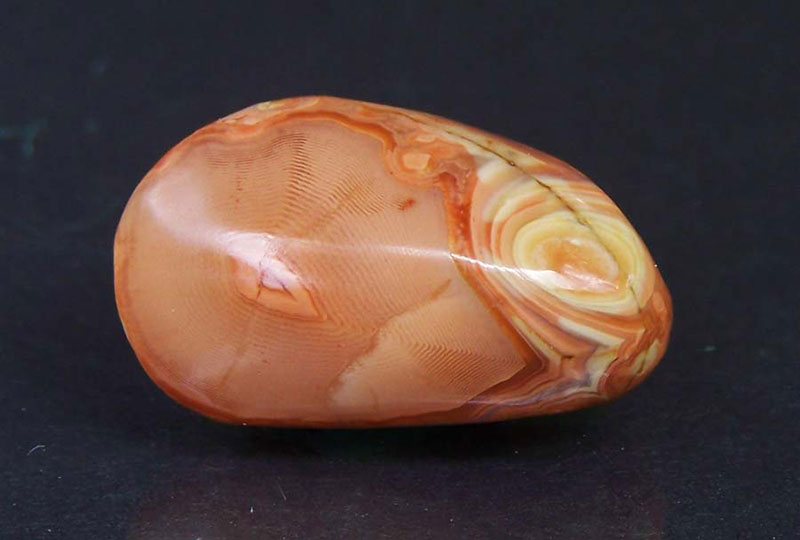
The first is a yellow-orange shadow agate found in Sedar Bay.
David also found this incredibly rare Lake Superior cloud agate.
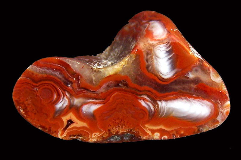
How about David’s copper replacement agates from the Keweenaw!

David’s next agate is a rare dendritic, also out of Sedar Bay. He explained in his email that this Laker has inclusions of hematite, goethite, and limonite in a chalcedony gray agate fill with some minor Adularia.

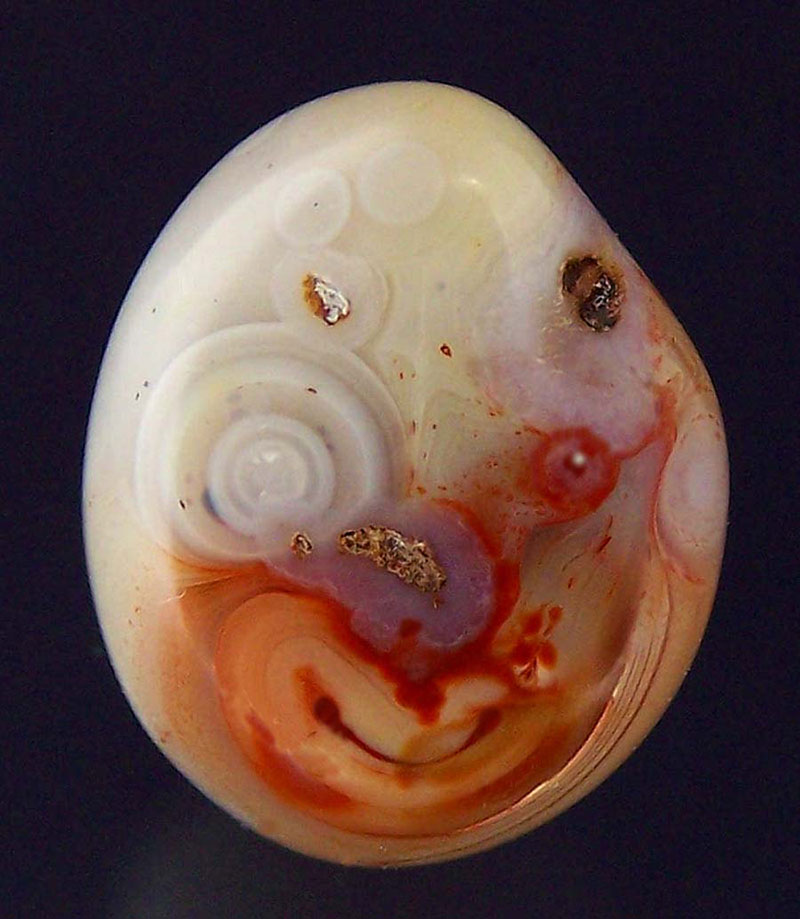
The last agate photo submitted by David is one that he calls the clown agate.
Brandon Haddock visits Grand Marais several times a year, including in the winter when he and his friend goes winter camping. Here are a couple of photos of nice agates that Brandon found last year in the Grand Marais area.

Tony from the Granite Falls, MN area found this nine ounce agate and sliced the end off.

Last September a family visited my booth to show off some fantastic agates. Too much time has passed and I no longer can locate the card on which I recorded the name. If you see this and would like your name included, please email me at Karen@agatelady.com.

The other day Mark Buda from Bay City, MI visited the museum again. When he was here last year, he told me about acquiring a number of agates from an estate sale, including two large Lake Superior agates. He had the scuffed up one face polished. The first face polished specimen is four pounds. It includes some fortification sections as well as several tubes. The other specimen is a five pound fortification agate.

ROCKHOUNDING AND ADVENTURE TRIPS: Hawaii – June 2015

Late last year I received an invitation to go to Hawaii — again. As some of you know, I was fortunate to be able to go to Hawaii a few years ago (thanks to the generosity of friends and frequent flyer miles). However, during that first visit to Hawaii I was not able to go to the Big Island. The item on top of my bucket list has been to see an active volcano. So when this new invitation was to go to the Big Island and stay for free with friends – I decided to do it. To help pay for the trip I dove into a closet that I have not looked in for 17 years, which was full of artifacts, old photos, and other items. I sold some of the things from my blog and now have several notebooks with this collection in the museum’s gift shop Thanks to Sharon Smith for the invite and the good time, and to Steve and Dorothy Moon for their hospitality, generosity, and amazing excursions.

During the time we were on the Big Island, there was a lot of volcanic activity. Lava is currently flowing into the ocean on the southeast side of the island. A picture of the steam cloud is below.

Early in our visit we decided to drive to the top of the world — Mauna Kea. If you count the total height of the mountain from the bottom of the ocean floor, this volcano is over 33,000 feet – taller than Mount Everest. The photo below shows the first view of Mauna Kea after we drove above the almost permanent cloud layer (which that day was at 6,500 feet). The next photo is the sister volcano – Mauna Loa.

The diagram below features Mauna Loa, which is larger In volume but smaller in height. Both mountains are the top two tallest in the world.

Here are a couple of photos I took from the top of Mauna Kea.

Because of successive lava flows, sometimes molten pathways become covered and form lava tubes, or pukas. Sharon and I went and checked one out in the Volcanoes National Park.

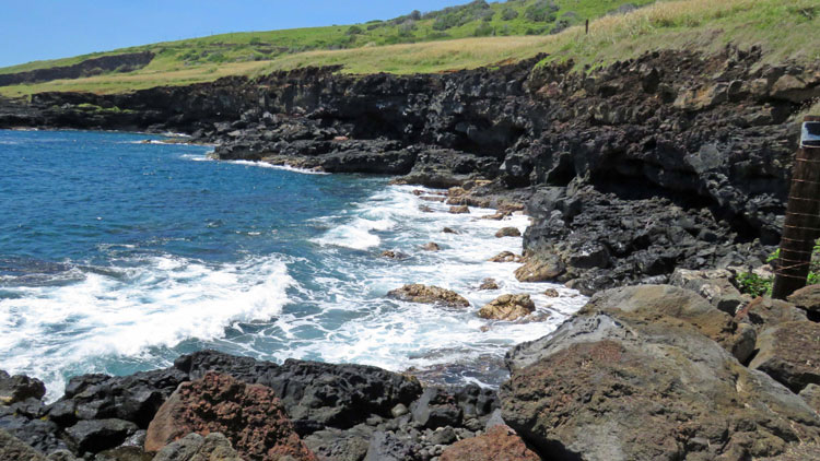
Basaltic rock is everywhere on the Big Island – geology in your face to be sure! Below is a picture of rough basalt that is only a couple of hundred years old. The next photo below shows a finger of lava from Mauna Loa that flowed around one hundred years ago.

Since I live in Grand Marais, I am used to Lake Superior sand. In my research before the trip, I found out that there is a green sand beach on the Big Island – one of only four in the world. We had to walk in one-way three miles or so, but it was worth it. The green comes from the olivine crystals that were embedded in the basalt, but then eroded out. The beach is surrounded by half a lava crater.

There are also black sand beaches that consist of sand-grain size pieces of basalt.

The southernmost point on the Big Island is the southernmost point in the U.S. The photo below shows an area near the southern tip.

The other highlight of the trip was seeing active lava at a side vent of Kilauea. Here are photos I took from the viewing platform of the same side crater during the day, and one at night. Two weeks after we were standing at this spot, the side of the crater caved in.

MINERAL OF THE MONTH: June 2015 – Petoskey Stone (Michigan)

Okay, I will admit it. I didn’t realize until now that in this version of my webpage I have not yet featured the state stone for Michigan: the Petoskey stone. As I have changed webmasters over the last dozen years or more, the content of the webpage has also changed since I have started fresh with each new webmaster that had his or her own server. I have been with my current webmaster since May 2007 (thanks Michael!). So don’t you think it is about time that I include my state’s stone as mineral of the month?

A Petoskey stone is both a rock and a fossil. The rock is fossilized remains of a particular species of coral that lived during the Devonian period — rugose coral, Hexagonaria percarinata.

They are fragments of a coral reef that was originally deposited during the Devonian period (419–359 million years ago). At that time a shallow ocean covered what is now the lower peninsula of Michigan. Diagrams of the Michigan Basin and the rock that made up the geology of this basin are below.


The coral reefs that formed Petoskey stones are shown in the Devonian rock colored red in the two diagrams below. Specifically, it is found in the Gravel Point Formation of the Traverse Group.

When dry, the stone resembles ordinary limestone but when wet or polished the distinctive mottled pattern of the six-sided coral fossils emerges.

Limestone is a sedimentary rock composed largely of the minerals calcite and aragonite, which are different crystal forms of calcium carbonate (CaCO3). Most limestone is composed of skeletal fragments of marine organisms such as the coral that makes up Petoskey stone. Limestone makes up about ten percent of the total volume of all sedimentary rocks in the Earth’s crust.

These state stones can be found because they were plucked from Michigan’s bedrock by glaciers that last retreated from the area around 10,000 years ago. Erosional forces ground off the rough edges of these pebbles and deposited them primarily in the northwestern (and some in the northeastern) portion of Michigan’s lower peninsula. In these areas, complete fossilized coral colony heads can be found in the source rocks for the Petoskey stones. In 1965, it was named the state stone of Michigan.

CITES:


History’s Gem of the Month: Vintage Grand Marais Photos

June 2015

This past winter one of my projects was to dive into a closet that has not seen the light of day for 17 years. The closed contained Grand Marais historical items. Back in 1998 I had gone through all the artifacts and organized them into categories. Some of the items were not conducive for being incorporated into museum displays. Other items were duplicates. One of the things I forgot that I have is a collection of large format film negatives of Grand Marais from a century ago. I also had dozens of vintage prints and post cards.

The film negatives intrigued me. I researched on the Internet the available methods of converting old film negatives into positive images and was excited to find out there are new scanners that do this automatically. I have wanted a high quality scanner for the past few years (since one that I had stopped working), so I decided to purchase one of these new types of scanners. Not only was I able to use the new scanner to convert the film negatives to positive JPEG images, but I also scanned all the vintage prints and post cards. Some of the images are included in this update.

The first picture below shows how many trees there were in Woodland Park a century ago. When the largest lumber company pulled up stakes and left Grand Marais in 1910, it donated three prime parcels of land to Burt Township. A campground was established in two of these lots; a baseball field was left intact on the third lot. Today, the recreation center, ice arena, basketball court, and tennis courts are on this third lot. During the last few years Burt Township has cut a lot of the trees down in Woodland Park. In fact, my son now calls it “woodless park.”

Prior to 1893 Grand Marais had very few residents. Everything changed in 1893 when a large lumber company located in Seney, MI decided to move its entire operation to Grand Marais. This company already had a short-line railroad from Seney half way to Grand Marais, so they extended the railroad the remaining 15 miles. In Grand Marais they constructed different railroad stations. The first photo below shows the passenger train that stopped at the head of Grand Marais Bay where the picnic shelter is now located. The second photo below shows a local dog sled team with the train in the background. Dog teams were commonly used by Grand Marais residents to get around during the winter. The third photo shows the railroad warehouse, which was located along the bay. This building no longer exists.

This next photo shows the Marais Lumber Company that was located where the marina is now situated. The trees cut west of town were dragged to the Log Slide and pushed down a chute to Lake Superior. Then they were corralled in a boom and floated seven miles east to Grand Marais. Trees cut east of town were transported by several short line railroads, none of which survive to today.

A century ago Grand Marais was a much larger town. The official census documented over 2,000 residents, but the actual number was probably a lot higher since there were many hundreds of transients that worked in the lumber camps. The photo below shows Main Street.

With the increase in commerce not only in Grand Marais, but throughout the Lake Superior region, the U.S. government established a series of lifesaving stations including one in Grand Marais that was located at the end of what is now called Coast Guard Point. A picture of the original lifesaving station is below. The next image shows the first lifesaving boat, led by Captain Trudell. How would you like to head out into a Lake Superior storm with this type of boat?

Although the lifesaving station was very competent, these brave men could not prevent shipwrecks – but could save the crews of the doomed vessels. The southern shore of Lake Superior is called “the graveyard coast.” Hundreds of ships sunk between Whitefish Point and Marquette, including dozens in the Grand Marais area. The photos below show ships that sunk just outside Grand Marais harbor in a fierce storm. This storm took out the Galatea and the Turret Crown. More information is included in the History Gem posting from July 2010 about these shipwrecks (see archive at the bottom of this page).

Although the lumber companies thought they had an almost unlimited supply of lumber in the Grand Marais area, it took less than 20 years for them to clear cut the surrounding country side. In 1910 the larger mills shut down. The mill owned by Alger and Smith moved their entire operation to Minnesota. Although railroad service was shut down immediately, since the lumber company took their train with them, innovative residents of Grand Marais were able to use the tracks for a few years by fashioning track-compatible coaches pulled by horses. By 1914 the lumber company finished taking its train tracks, too. For the next five years Grand Marais was a very isolated town. The only way to get to Grand Marais was by boat in the warmer months or by dog sled in the winter months. The photos below shows the temporary Seney stage.

CURRENT GRAND MARAIS SCENES: June 2015

NOTE: More Grand Marais scenes are posted often on my blog at www.agatelady.blogspot.com and on my main personal Facebook page at https://www.facebook.com/karen.brzys . I also post agate photos, shared mostly on various Facebook rockhounding sites to the museum’s Facebook page at https://www.facebook.com/pages/Gitche-Gumee-Agate-and-History-Museum.

For this webpage update, I have selected some of my favorite pictures from the late winter and early spring.

First, here are a couple of photos of the outer harbor lighthouse at the end of the channel leading into Grand Marais Bay. These photos were taken when the ice around the lighthouse was at its peak in late April.

Check out this view from the bluff on the south side of the bay looking across the new breakwall toward the channel leading into the bay.


Late April is the best time to take pictures of the shore ice. These pictures were taken from the bluff in the Grand Sable Dunes, looking west and east.

Here are a few of my favorite photos taken also in late April. The first shows deer on the beach near First Creek on the west side of town. The second shows a still frozen Sable Lake as seen from up in the dunes.

At the end of April, I walked out onto the breakwall for the first time this year. Each spring is like a right of passage when we do a lot of “firsts” including walking the breakwall, driving the back road to Munising, accessing the bluff (used to be a beach) east of town, etc. There was still floating ice in the channel and across the mouth of the bay looking east. The sunset shows that there were also icebergs looking west.

In early May we had some warm days that melted most of the snow and almost entirely reduced the icebergs. However, you can still see the iceberg remnants in the photos below taken from the trail between the Log Slide and Au Sable Point.

The dunes with the last of the snow are shown in the picture below. I love this time of year since the snow, sand, and dune grass provide a lot of contrast.


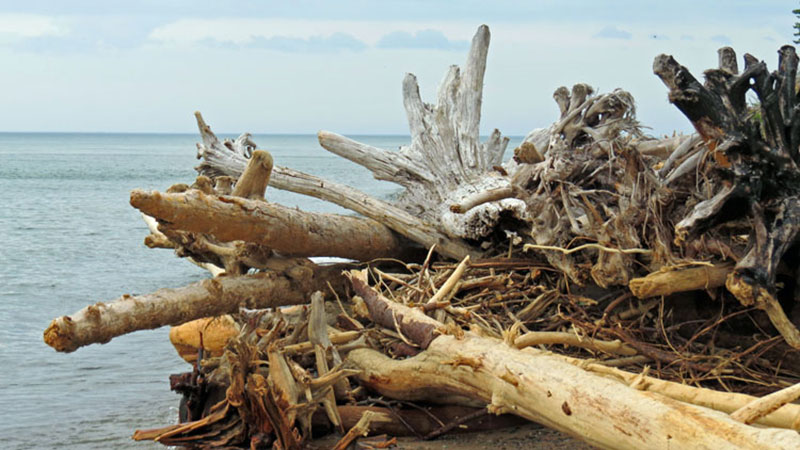
If you like driftwood, spring is the best time to comb the Grand Marais beaches. Once the tourists start coming, much of the driftwood fuels beach fires (including some of ours).

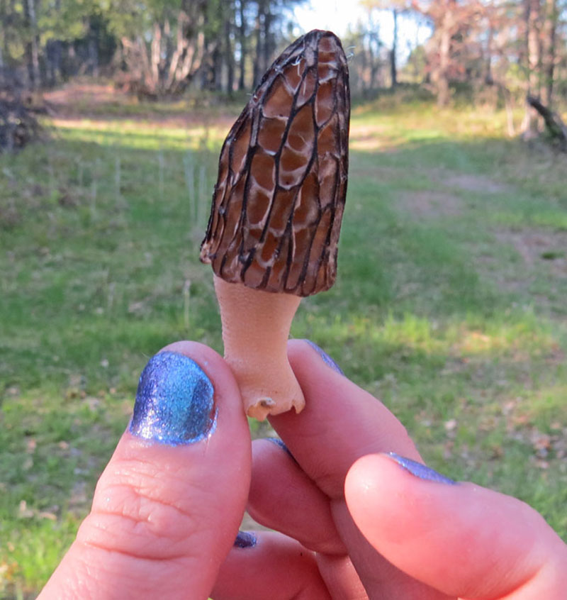
Sure signs of spring – trilliums and morels.

CUSTOMER AGATE FINDS: Lake Superior Agate Close Up Photos February 2015

With winter the museum is not open so I do not have any current customer agate finds. So for this month’s update I searched through my supply of close up photos of Lake Superior agates. Some of these pictures I took using either my USB microscope camera or my Nikon. Some are also cropped pictures from my agate book, Agates Inside Out. These pictures were taken by Tom Shearer.

MINERAL OF THE MONTH: February 2015 – Condor Agate (Argentina)

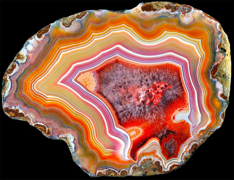
The condor agate was discovered and named by Luis de los Santos in 1993 in the Andes Patagonia Mountains near San Rafael, in Mendoza Province, Argentina. This agate exhibits vibrantly colorful bands and patterns, and has become a popular stone among collectors and jewelry designers. Close up photos of the condor agate shown above follow.

Luis had collected rocks as a child. This interest was rekindled when he saw a carved stone egg made from rhodochrosite, a local Argentinian mined mineral. On one of Luis ‘s visits to the Catamarca Province, he happened to talk with and old friend of Dr. Franz Mansfeld, a German geologist noted for his expertise regarding the Catamarca rhodochosite deposit. This friend told Luis that the geologist had also seen an agate in the Northern region of Patagonia. Luis went in search of these agates, so he made repeated visits to the area.

Rather than randomly hiking the mountainous region, Luis saw a broken piece of banded agate being used as a doorstop by one of the locals. He finally tracked down the agate deposit in an expansive area consisting of low hills located a considerable distance from the nearest road. The only way to get to the sight was on horse-back. The impressive agates were scattered over the surface of rock outcrops made of volcanic rhyolite and andesite. As it turns out, the agate nodules had naturally formed in hollow pockets within this igneous rock. The specimens spread over the surface had weathered out of the matrix rock. Realizing he had made an important find, Luis collected what he could and headed to the United States to sell the specimens. Theyt sold instantly and have been selling ever since. After several years of collecting, cutting, and polishing, he did not continue the business. However, his former wife, Ana de la Santos, picked up where Luis left off and has intensified the business since 2008. Ana now travels to Argentina twice a year and hires a crew to help her mine. Today, the surface specimens are long since gone, so mining requires digging shallow pits to find the nodules.

CITES:

History’s Gem of the Month: Michigan’s Mystic Dunes;Where Wily Paw-Puk-Keewis DancedBy Arthur W. Stace Date and source unknown

February 2015

NOTE: I found this newspaper article in the Gitche Gumee Museum’s archive. At the beginning of the article, it states that this is number 27 in a series of touring articles dealing with the Dunes of Michigan.

Four score years ago Henry Wadsworth Longfellow gave to the reading world his rhythmic “Hiawatha,” epic of th Northland Indians. Ever since that time children and grown-ups of the English speaking world have read in succeeding generation of the “Dunes of Nagow Wudjoo,” where Pau-Puk-Keewis, the mischief maker “whom the people called the “Storm Fool” danced at Hiawath’s wedding to Minnehaha, Laughing Water.

“On the shores of Gitche Gumee,
On the dunes of Nagow Wudjoo
By the shinning Big-Sea-Water,
Stood the lodge of Pau-Puk-Keewis.
It was he who in his frenzy
Whirled those drifting sands together,
On the dunes of Nagow Wudjoo,
When among the guests assembled
He so merrily and madly
Danced at Hiawatha’s wedding,
Danced the Beggars’ Dance to please them.”

How many Michigan children and how many Michigan grown-ups, reading the “Song of Hiawatha” have known that the “Dunes of Nagow Wudjoo, by the Shining Big-Sea-Water” are the dunes on the Grand Marais shore of Lake Superior in their own home state?

How many tourists speeding along M-28 and Us-2, main east and west arteries of travel in the Upper Peninsula – and mistakenly thinking that in so doing they are really seeing the Upper Peninsula – know that 25 miles north of M-28 and 42 miles north of US-2 are massed some of the most astonishing, most breath-taking dunes on the North American Continent?

Lonely, Remote Shore

The reason that the “dunes of Nagow Wudjoo” are little known in spite of the immortal and international publicity given them by Longfellow is that they are on a remote, deserted coast of Lake Superior, unfrequented by present-day travelers.

They were, perhaps, better known to the travelers of Indian days, of missionary days, of trader days, of pioneer days than to the far more numerous tourists of today because in those far-off times the principal means of transportation was by water. The canoes of the Indians, the barges of the traders, the sailing craft and steamboats of explorers and pioneers passed along the shore. The these tourists of primeval Michigan the towering dunes atop the bluff extending from Grand Marais harbor to Au Sable Point were outstanding landmarks. They were in sharp contrast to the steep, jagged cliffs of the Pictured Rocks, their immediate scenic neighbors on the shore to the west.

The dunes impressed themselves on the minds of the Indians. They impressed themselves on Henry Schoolcraft, explorer, student and collector of Indian lore. It was from Schoolcraft’s writings that Longfellow is said to have derived the descriptions and the legends he embodied in word music in “Hiawatha.”

The “dunes of Nagoe Wudjou” were on a lonely shore in Hiawatha’s time, in Schoolcraft’s time. They are on a lonely shore today. The exploring tourist may reach then by way of Highway M-77 to Grand Marais, thence by a local road to Grand Sable Lake two miles to the west.

NOTE: The photo in the article was quite faded without contrast, so I substituted my own photographs.

CURRENT GRAND MARAIS SCENES: February 2015

For those of you who miss the monthly updates to this webpage and have not checked out other Internet sites at which I post photos on almost a daily basis, please check out my blog at www.agatelady.blogspot.com. I also have Facebook pages. Unfortunately, there are more than one. My main personal Facebook page is at https://www.facebook.com/karen.brzys . I have checked in the past how one can merge Facebook pages. The task is not easy if not impossible. I’ll have to revisit this again. If any of you know how to merge FB pages, please email me at Karen@agatelady.com.

For this webpage update, I have selected some of my favorite pictures from the Fall and early Winter. Let’s begin with a couple of photos from the Chapel Loop hike I did with friends in October.

A fall sunset from the beach in Grand Marais.


Here are a few pictures I took during the early winter months in November and December. We received a huge amount of snow in December with one multi-day blizzard that dumped more than two feet of the white stuff.

One of the reasons I purchased a camera with a powerful built in zoom lens is to have the ability to quickly capture photos of animals. Below are two pictures I took of whitetail deer and one of a muskrat.

This is the third winter in a row that we have received a lot of snow. If we would not have had the partial melt in December, we would be even more buried than we are right now. Pictures took the first few weeks of 2015 show just how much snow we have received.

First, here is a formation in the shelf ice (that we locals call icebergs). These two photos were taken a few weeks apart.

More winter photos…..

The depth of the snow as of early February is shown in the two pictures below. The first photo is of a garage located out on Coast Guard Point. The second photo shows the snow depth on the south side of my house.

CUSTOMER AGATE FINDS: September 2014

The agate hunting this summer has been OK, but not great. We were expecting a superb summer due to the massive amounts of ice on Lake Superior last winter. It has been many years since we had a lot of ice. In fact, according to NOAA the ice coverage on Lake Superior is down 70 percent since the mid-1970s. When the ice first begins forming in early winter, it forms at the high water mark where rocks get stuck under the ice. Wind shifts can cause the ice to break away and float around Lake Superior carrying its load of rocks. Normally, the spring storms with their north to northwest winds blow the ice with imbedded rock to beach between Grand Marais and Whitefish Point, where the ice melts and dumps its load. Memorial Day weekend we were down the beach and calling the icebergs in. Nature had another plan. For the next four days the wind blew strong from the south and blew the ice north to Canada. The ice never came back.

Despite the ice not bringing new rock to our beach, there have been several great agates found this summer. For this web page update I’ll include several.

The first agate was found by Grand Marais resident, Michael Kinlaw. Good job, Michael!

The next agate was found in the Grand Marais area in June by Sally Shippy.

Gordon Stanlake from Brown City, MI found several nice agates in the Grand Marais area.

My process for trying to link the photos with the agate finder names is to write their names on a business card along with their home towns and dates that I took the pictures. I have one card with no date so I am hoping that this is Peggy Bowman from Clyde, MI with her agate. If not, please send me an email to .

Jack Kitchen from St. Clair Shores, MI found this nice candy striped Laker that also has some shadow bands.

B.B. Bodin and Mark Bowen are rookie agate hunters. They bought my book and took the online class last fall and winter. Here are just a few of the dozens of large agates they have found this spring and summer.

Summer resident, Carol Rose, took my onsite rockhounding class several years ago. She is now an avid and successful agate hunter. Good job, Carol!

Jane Anderson from Fridley, MN stopped by the Gitche Gumee Museum to show me some of her agate finds. She did find these in Minnesota.

I may have mixed up a few of my note cards. The only card I have that corresponds with the dates for the two photos has listed Janel Novak. If these are your agates and you are not Janel, please send me an email to .

I have a feeling that the agate found by Peggy Bowman from Clyde, MI is shown below. I face polished this agate; the before and after pictures show the transformation.

Tyler Orton from Caro, MI found this nice Lake Superior agate.

The Chickering family had good agate hunting luck as they visited various beaches across the Eastern Upper Peninsula.

Here is an agate found by Priscilla from Kingsford, MI. She found it near Muskallonge State Park around three years ago. This is a “skipping atom agate.” After seeing several of these, I believe that the quartz in these specimens have metamorphosed into this unusual pattern.

A frequent museum visitor who did not want to be photographed brought into the museum on June 11th. It is an interesting tube agate.