MINERAL OF THE MONTH: September 2011 – Petoskey Stones

In 1965 the state stone for Michigan was designated as the Petoskey stone. Petoskey stones are fossils of coral colonies called Hexagonaria. “Hex” comes from hexagon, because the coral is usually a six-sided polygon. The coral grew 350 million years ago, 150 million years before the dinosaurs! It grew only in shallow tropical salt-water seas where lower Michigan is now. The coral stacked in layers, then fossilized into rock.

The Petoskey stones found on the beaches of Lakes Michigan and Huron were formed as a result of glaciation, in which sheets of ice plucked stones from the bedrock, grinding off their rough edges and depositing them primarily in the northern portion of Michigan’s Lower Peninsula. In some areas of Michigan, complete fossilized coral colony heads can be found. The formations and specimens found inland tend to be rougher since they have not been weathered as much by the wind, water, and sand from the shoreline. The movement of the frozen lake ice acting on the shore during the winters is thought to turn over stones at the shore exposing new Petoskey stones at the water’s edge each spring.

Similar fossil corals occur in a variety of locations; however the name Petoskey stone should only be applied to those from Michigan which exhibit a six-walled coral structure that has the distinctive “eye” pattern within each cell.

When ancient glaciers pressed down on the center of the Lower Peninsula, the layer of fossilized coral rose up to form a ridge and created the dish shaped “Michigan basin”. The exposed layer of rock is where Petoskey stones come from. Petoskey stones are found in the Gravel Point Formation of the Traverse Group. They are fragments of a coral reef that was originally deposited during the Devonian period. When dry, the stone resembles ordinary limestone but when wet or polished using lapidary techniques, the distinctive mottled pattern of the six-sided coral fossils emerges.

It is sometimes made into decorative objects. Other forms of fossilized coral are also found in the same location including the closely related favorites. Favosites is an extinct genus of coral characterized by polygonal closely-packed corallites (giving it the common name “honeycomb coral”). The walls between corallites are pierced by pores which allowed transfer of nutrients between polyps.

The name comes from an Ottawa Indian Chief, Chief Petosegay. The city of Petoskey, Michigan, is also named after him, and is the center of the area where the stones are found. According to legend, Petosegay was the child of a descendant of French nobleman and fur trader, Antoine Carre and an Ottawa princess. Petosegay, meaning “rising sun”, “rays of dawn” or “sunbeams of promise”, was named after the rays of sun that fell upon his newborn face. In keeping with his promising name, Petosegay was a wealthy fur trader who gained much land and acclaim for himself and his tribe. He was remarked upon to have a striking and appealing appearance, and spoke English very well. He married another Ottawa, and together they had two daughters and eight sons. In the summer of 1873, a few years before the chief’s passing, a city began on his land along Little Traverse Bay. The settlers christened the newborn city Petoskey, an anglicized form of Petosegay.


History’s Gem of the Month: Michigan Log Marks

 September 2011

The historical information included in this web page update has been taken from two sources. The subject involves the log marks used by lumber companies during the logging boom. The Michigan State College (now Michigan State University) published a pamphlet in January 1942 entitled Michigan Log Marks. (Memoir Bulletin No. 4, edited by Harold Titus, East Lansing). Additional information about lumbering was supplied by an article written by Maria Quninlan, originally published as a Great Lakes Informant (Series 3, Number 2). Additional information was also taken from the web page http://agilewriter.com/History/Mi_lumber.htm.

Michigan’s Logging History – A Summary

During the 19th century, Michigan’s forests yielded more money and created more millionaires than did all the gold mined during California’s Gold Rush. In turn, this wealth fueled the great financial and industrial rise of the state at the beginning of the 20th century. White pine, the most common tree, was preferred because it was easy to work and grew straight and tall. The largest specimens were 300 years old, 200 feet tall and up to 8 feet in diameter. Other abundant species were maple, elm, basswood and yellow pine.

Geographic factors played an important part in the development of Michigan’s lumber industry. White pine, the wood most in demand for construction in the nineteenth century, grew in abundance in northern Michigan forests. The state was also crisscrossed by a network of rivers which provided convenient transportation for logs to the sawmills and lake ports.

By 1840 it was apparent that the traditional sources of white pine in Maine and New York could not supply the growing demand for lumber. Michigan, the next state west in the northern pine belt, was the logical place to turn for more lumber.

The production of Michigan lumber increased dramatically during the middle decades of the nineteenth century. The Saginaw Valley was the leading lumbering area between 1840 and 1860, when the number of mills in operation throughout the state doubled, and the value of their products increased from $1 million to $6 million annually. Rapid growth continued, and by 1869 the Saginaw Valley alone was earning $7 million yearly.

As the potential of the lumber business became apparent, companies were organized to begin commercial logging in other areas of the state. Many rivers that could carry logs quickly were transformed into a valuable means of transportation. By 1869 Michigan was producing more lumber than any other state, a distinction it continued to hold for thirty years. In 1889, the year of greatest lumber production, Michigan produced approximately 5.5 billion board feet. (1 foot long, 1 foot wide and 1 inch thick).

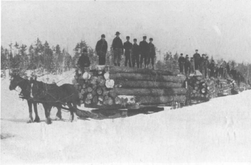
The increased lumber production during the final decades of the nineteenth century was due in part to changes in machinery and techniques which brought greater efficiency to the industry. Throughout the first half of the nineteenth century lumbering had been a weather dependent and seasonally limited enterprise. Cutting was done during the winter when timber could be pulled on large sleds, if there were snow, from where the tree had been felled to banking grounds along a river.

The river drive was also dependent on a good winter snowfall for it was the spring run-off which enabled the rivers to carry the huge pine logs to the sawmills. Log drivers were usually men who had spent the winter in the woods cutting timber. It was their job to control the flow of the river by building and breaking dams and to break up log jams they could not prevent.

Sawmills were most often located at the mouths of the driving rivers. Associations were formed to cooperate in the sorting of logs into a pond or bay where floating “booms” of logs separated the property of one company from that of another. From the booms logs were floated to the mills to be sawed.

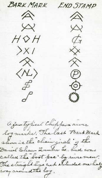
The logs were identified and sorted by the marks that were applied to the logs. Log marks were to Michigan what cattle brands are to the grazing states. The billions of board feet cut by thousands of operators would have been chaotic without log marks. These identifying symbols were recognized by law. Lumbermen identified ownership of logs by hacking or stamping symbols on them. Initially, the marks were cut into the bark by ax, so the designs were limited to straight lines, simple initials, triangles, squares, and combinations of these. At first, some business men tried to control the rights of using rivers to transport logs, but in 1853 a court decision was made declaring that all persons using rivers had equal rights. To the lumbermen, it meant that they could continue to float logs without interference from land owners. In 1855, the state legislature passed an act to provide for the formation of companies to run, drive, boom and raft logs.

As the logging business grew, those marking and sorting the logs ran into issues. Although there was an attempt to mark the light side of the logs so that the marks would float upward, or to mark two sides of the log – it was still difficult to efficiently see all of the marks. Besides being limited in design and varying somewhat according to individual wielders of axes who cut the marks, this process of cutting the log marks slowed down the operation. Thus, in 1859 a law was enacted to require owners of logs floated in the Muskegon river, or its tributaries, to mark the ends of their logs (rather than the sides) in a distinctive manner and to register the marks in the local county. The law was revised in 1864 that gave boom companies full power of contract to enforce log mark registration requirements. Provisions were also enacted to make it illegal to remove or change a log mark, which unscrupulous men were doing to steal logs from other companies. In fact it was because of log stealing that the main logging companies in Seney relocated to Grand Marais. They discovered that people were stealing their logs being floated down the Manistique River.

Most trees were felled by axes until the 1870s, when crosscut saws were improved so that they could be used to cut down standing timber. Two Michigan-initiated innovations of the 1870s were responsible for the largest increases in logging production. The Big Wheels invented by Silas Overpack of Manistee enabled cutting to continue in the snowless seasons by providing an alternative to sled transportation. As its name implies, this device consisted of a set of enormous wheels drawn by a team of horses. Logs were chained beneath the axle, and once the inertia of the load had been overcome, it was relatively easy to keep the wheels moving.

Like the logging wheels, the narrow gauge railroad helped to make lumbermen independent of the weather. Trains could be used in place of sleds year round for the relatively short run to the riverside banking grounds, or the river drive itself could be ended by carrying the logs to a mainline railroad depot. In addition, the logging railroad was sufficiently economical to allow cutting in areas that had been considered too far from the nearest driving stream to make sledding practical.

In their haste to move on to new cutting sites, loggers usually gave little thought to the lands they were leaving. By the 1870s stumps and branches already littered much of northern Michigan. There was no longer any barrier to erosion on cutover land, and the dried debris created an enormous fire hazard. At the end of the dry summer months fires frequently broke out, sometimes moving into still uncut timberlands or settled areas, as in 1871 and 1881, when fires broke out across the state. These dangerous conditions in the former logging districts inspired, in large part, the first attempts to conserve Michigan’s natural resources.

The primary effect of the lumber industry upon the State of Michigan was economic. The timber boom in the latter half of the nineteenth century brought millions of dollars into the state, both to lumbermen and those who supplied them. Thousands of men and some women found employment in some aspect of the business. The decline of lumbering also had its effects; both individuals and entire villages and cities, formerly thriving, lost their most important source of income. In Grand Marais, the logging era ended in 1910 when the lumber company took its railroad and tracks to Minnesota. The town’s population dropped from a couple of thousand permanent residents (plus a couple of thousand transient workers) to only a few hundred by 1914. Those who stayed in Grand Marais were a hardy bunch since the road was not put in until 1919. In the winter, it was difficult if not impossible for people or supplies to get into or leave Grand Marais.

The lumbering era also saw vast changes in the natural environment of northern Michigan. The conservation programs in effect today on state lands grew out of concern over the conditions the loggers had left behind them. Another legacy evident today is the body of songs and stories about lumbering, an important part of the folklore tradition of Michigan, and indeed, of the entire nation.

CURRENT GRAND MARAIS SCENES: September 2011

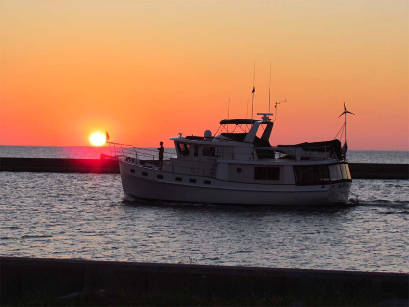
It was difficult to select the photos I want to feature in this update. I must admit that I love taking pictures with my camera and because I have taken so many pictures these past few months (since the last web page update), I have thousands from which to choose. During the summer months, it is especially fun to take pictures of sunrises and sunsets. This is the only time of the year that the sun rises and sets far enough north that we can see it out over the lake from Grand Marais. I don’t get down to the lakeside to take many shots of sunrises, but in early August I couldn’t sleep early one beautiful morning and I headed down to the breakwater at the end of coast guard point. Just as I pulled up next to the Lighthouse Keeper’s museum, a fishing boat was heading through the channel out into Lake Superior.

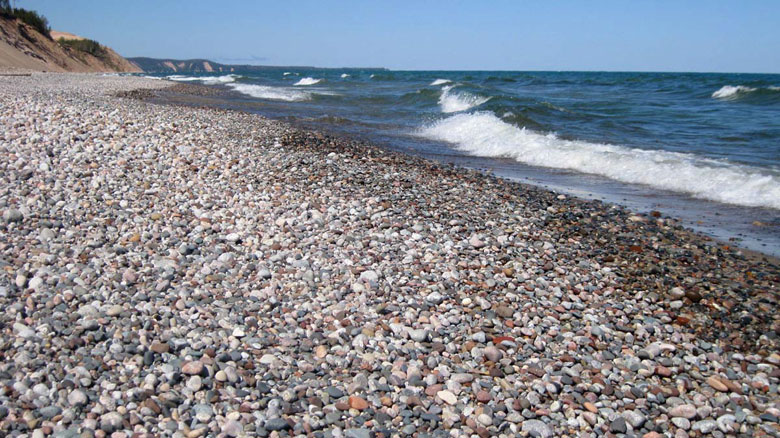
I have had almost no time this summer to agate hunt along the local beaches. One evening I did head east of town and squeezed in a few minutes walking along the rocks.

There are many sunset pictures in my archive from this summer, but here are a few of my favorites. The first one shows the sun setting over coast guard point. The second one shows the afterglow of sunset in the background (pink sky) and a couple of the sailboats in Grand Marais bay in the foreground.

I had two opportunities to capture couples enjoying sunsets. The first was taken at 12 Mile beach campground and the second was taken on a beach located just west of Munising. Notice Grand Island in the background.

We have had several storms this past month, many of which resulted in huge waves pounding the shore. Here are a couple of shots taken along the Mosquito-Chapel Loop hiking trail in the Pictured Rocks National Lakeshore. Some of the splashes from the waves were blasting more than 100 feet in the air! The second picture below was taken on the back side of Grand Portal Point away from the wind.

Here is yet another picture showing waves plummeting the breakwater and lighthouse in Grand Marais.

CUSTOMER AGATE FINDS: Spring 2011

Since spring has sprung in Grand Marais, rockhounds have been out to hit the beach. Since I have not had time to do a web page in a while, I’ll include several agates for you rockhounds to drool over.

First I’ll start by featuring the agates found by my friend, Dan Kinney, who lives in the Soo. He backpacked from the mouth of the Two Hearted River west to Deer Park. He had intended on getting all the way to Grand Marais, but the weather turned cold and rainy and was not conducive to agate hunting. He didn’t find any huge agates this time, unlike most of his agate hunting adventures, but he found some wowsers. Here are a couple of group shots of his agates, as well as a close up of my favorite – a nice candy striper.

Next is a peeler Lake Superior agate found in Minnesota by Brad Huus from Duluth .

Herb and Wendy Confer from Owosso, MI visited the museum in late May to show me some of their finds. They also gifted my assistant, Candace, and me with a bottle of pure maple syrup. I’m sure Candace and her husband appreciated it as much as I did! They found over 40 agates, including one with an amethyst center fill.

Jeff Robbins from Lake City, MI also came by the museum. Below is a picture of a ¾ pound Lake Superior agate he found east of Grand Marais last August on an already picked-over beach.

Bryan Wolbrink and his wife from the Grand Rapids area showed off some of their agate finds. They both love visiting the south shore of Lake Superior to look for agates.

Last but not least is an email submission sent to me from Pam Rideout and Margi White. The photo is of agates they found in Washington state.

ROCKHOUNDING AND ADVENTURE TRIPS: Grand Canyon – 2011

Since my friends knew I was driving out to the Tucson Gem Show, three asked whether I was going to again hike the Grand Canyon. I love sharing the canyon with friends, so a year ago I made the necessary reservations. I hiked with friends Wendy, Helen, and Phylster. We stayed at Bright Angel Lodge the night before our descent. We hiked down the South Kaibab Trail to Phantom Ranch, where we stayed for two nights. On the day we spent at the bottom, we went on a day hike up the Cedar Creek trail to the section that overlooks the Colorado River. Then we hiked out the Bright Angel Trail. In all we hiked 21 miles with 12,000 feet of elevation change. Considering that all four of us are in our mid-50s, we did well to complete the hike with no injuries – not even a blister! The weather was sunny and warm, which was amazing since it snowed at the canyon the three days after we left.

Included below are some of the pictures from the hike. More can be seen on the blog at www.agatelady.blogspot.com.

MINERAL OF THE MONTH: Spring 2011 – Petrified Wood

Petrified Wood can be thought of as a type of fossil. Fossils are formed from a petrification process, which is a geology term describing the method by which organic living material is converted into stone. Usually, this happens when the organic remains are buried in lava or sediments before they can decay. Petrification can take place in two related ways: replacement and permineralization. Replacement occurs when water dissolves the original hard parts and replaces them with mineral matter. The most common replacement minerals are calcite, silica, pyrite, and hematite. When the original organism is replaced quickly, the fossil usually loses the detailed structure, leaving behind just the original shape. Permineralization occurs when ground water carrying dissolved minerals infiltrates the microscopic pores. The minerals in this case replace the detail of the original organism.

The most famous example of petrification is the Petrified Forest in northern Arizona. However, this is not the only area known for petrified wood since it is also found in nearly every state and in many foreign countries. It is not known for certain who the first Europeans were to see the great display of petrified wood in Arizona. It was probably Spanish explorers during their expeditions in the 1500s. The earliest written record, however, dates from 1851 when an army officer mentioned petrified wood in a report.

At one time the northeast part of Arizona was lowland with numerous rivers and streams. In the basin there was a lush forest with conifer trees up to nine feet in diameter and over 200 feet tall. During the Triassic Period (200 to 250 million years ago), the area that is now Arizona was located near the equator. At that time, all of the continents had combined to form one super-continent called Pangea. Over time, trees in the area died. Rivers deposited the deceased trees in their flood plains or buried them in streambeds. Most of the trees decomposed, but a few were buried so deep that there was not enough oxygen to allow decay. To the west of this area were massive volcanoes that spewed ash into the atmosphere. Wind currents carried the ash and deposited it with the silt that buried the trees. Ground water dissolved silica from the ash and carried it into the buried logs. Over time, the silica in solution either replaced cell walls, crystallizing as quartz, or deposited in the air spaces within the wood tissue. This petrification process explains how cell structure, annual rings, and other features of the original trees were preserved.

As the petrification process continued, other minerals combined with quartz to create the brilliant rainbow of colors often found in petrified wood. In some cases minerals infiltrated later during the millions of years of burial as a secondary deposit in the cracks, checks, or other openings in the petrified or partially petrified wood. Iron oxides produced the great variety of shades of red, brown, and yellow. The black color was probably due to manganese oxide or carbon.

At first, the now petrified trees remained buried under 3,000 feet of sediment. However, around 60 million years ago this area was uplifted along with the Rocky Mountains. With the uplifting came erosion from streams and rivers that removed the overburden layers, exposing the petrified trees.

Some scientists classify petrified wood as agate; others do not. The determination comes down to two issues. First, the type of quartz needs to be identified. In some cases, most of the quartz in petrified wood is macrocrystalline, although there may also be some microcrystalline replacement. For those specimens that contain mostly microcrystalline crystals, the second issue is whether petrification was a replacement process, or whether it may have involved an agatization process. If the wood tissue was directly replaced by silica so that the wood fibers defined the structure, then petrified wood is not agate. If, on the other hand, each of the individual pore spaces self-organized and filled independently, thus creating individual agatized pockets, you could then classify petrified wood as a colony of agates. Depending on the specimen, there could be some of both structures.


CURRENT GRAND MARAIS SCENES: Spring 2011

It was again difficult to select pictures to feature in this update’s current Grand Marais scenes. Since I update the photoblog almost daily at www.agatelady.blogspot.com, there are a lot from which to choose. I decided to select pictures that capture the diversity of what you can see in the Grand Marais area if you are willing to get out and explore.

We’ll start out with some photos documenting the end of winter and beginning of spring. This is when the snow and ice begin to melt. Because sand is mixed in with the frozen precipitation, there are beautiful color schemes that develop during the melting phase. The first picture shows ice in the channel entering Grand Marais Bay. Shore ice hugging and extending from the beach is shown in the second photo. The tall structures in the third picture look like dunes, but they are actually 20-30 foot icebergs anchored right offshore. A storm the next day after I took this picture in early April broke apart the ice.

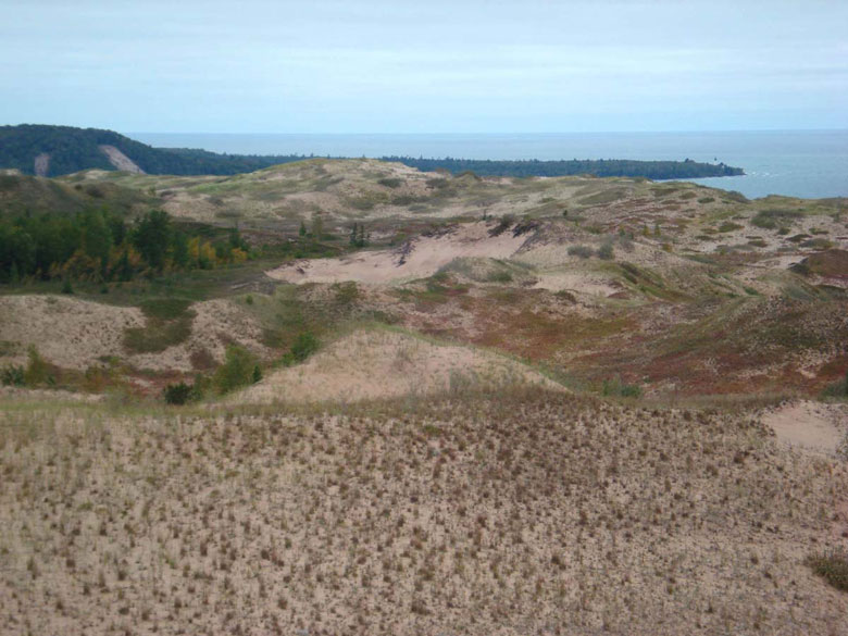
As many of you know, my favorite place to hike in the local area is the Grand Sable Dunes. This fantastic geologic formation contains some the world’s most pristine perched dunes. They cover a five-mile stretch of the Sable River and Au Sable point. Glacial ice that melted within the Superior Basin around 10,000 years ago produced many large rivers. These rivers deposited millions of tons of debris into many different configurations south of the Superior Basin. The Grand Sable Banks most likely originated along one of these glacial rivers.

Around 8,500 years ago, the Pictured Rocks area then became very dry when the Lake Superior basin changed its drainage pattern and began emptying to the north from its east end when this new outlet was the low spot. A north facing bluff formed and remained in place for 4,500 years right around the Grand Marais area.

Between 4,000 and 6,000 years ago, the landmass that is now the Upper Peninsula started to rebound upward from the weight of the previous ice glacier. This is called isocratic rebound. The U.P. is still rebounding today. The land forming the lake’s outlet at North Bay began to rise, which reduced the amount of outflow and caused water levels to rise rapidly. In fact, Lake Superior rose to about 40 feet higher than it is today! The rise in lake levels formed Lake Nipissing. Lake levels of Lake Nipissing also began to rise which caused the Grand Sable Banks to become unstable. The higher water eroded the bluffs which left them exposed to wind. A dominant northwesterly wind blew through the Grand Sable Banks which carried the wind from the bluff to the top of the flat upland. This sand was “perched” on top of the upland, hence the name, “perched dune system.”

The climate of the Grand Sable Dunes is typical of any Michigan climate. The winters are fairly long and cold while the summers are short and cool. The location of the dunes happens to be the second most cloudy area of the United States. The average cloud cover is approximately 70%. Grand Marais’ annual temperature is 40.8 degrees Fahrenheit with precipitation totaling 31 inches a year. During the winter season, snowfall accumulation ranges from 130 to over 200 inches. Because the dunes are so close to Lake Superior extreme low temperatures in the winter and extremely high temperatures in the summer do not occur.

If you plan on taking the hike to the Grand Sable Dunes the best way to get there would be to take the trail that starts at the west end of the Sable Falls parking area. While on the trail you will walk through an old field and eventually cross over a bridge that runs about Sable Creek. For the next ¼ mile you will go through the forests and dune transition areas. Along the trail, stop and take a look at the wayside exhibits. Another way to access the dunes is through the north country trail while is located ¼ mile east of the log slide.

To the west of the dunes is Au Sable Point. Here is a shot of the point and the Au Sable Lighthouse from the south side of the dunes.

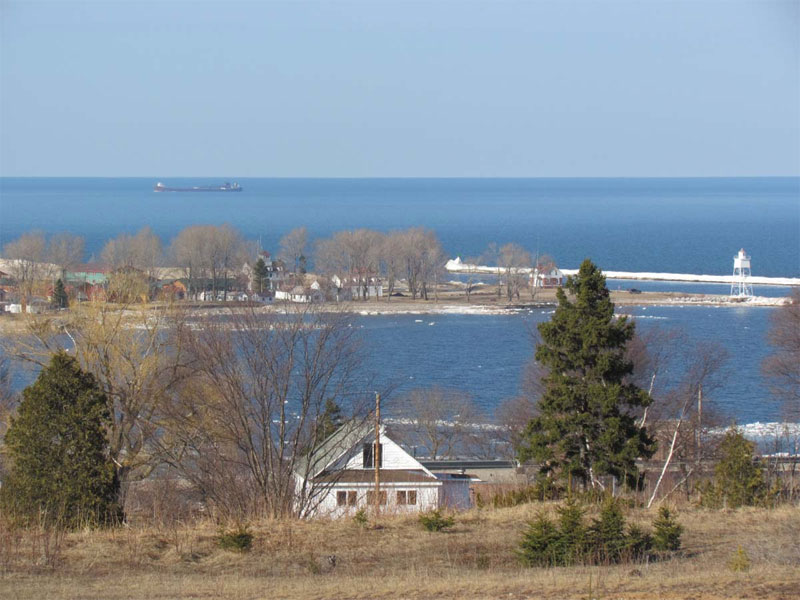
We have had quite a few freighters pass by Grand Marais as of late. Here is a shot from the hill south of town that shows a freighter passing by Grand Marais Bay.


A hundred years ago and more the south shore of Lake Superior was known as the Grave Yard Coast. Many schooners (which were the ship of choice back then) were taken out by the storms of Lake Superior. I did some research this morning to find out more about the shipwrecks. There were three ships that went down in a storm on November 19, 1914. Here are some articles about the wrecks:

Seney, Mich., Nov. 21. — Life savers reported today that a total of 12 bodies have been found on the south shore of Lake Superior during the 35 hours’ search which followed the fearful gale that swept the lake Thursday. The four bodies found since the searchers previously reported were all of men. The two corpses of women have been unidentified. Among the wreckage cast ashore today were several life belts stenciled “Steamer Curtis.” As no trace of the steamer C. F. Curtis was been obtained and as it is considered certain that one of her schooners, the Annie M. Peterson, sank near Grand Marais, local marine men believe the Curtis also went to the bottom. It is also claimed there were only seven persons on board the Peterson. The Curtis was known to have been to wing the schooners Peterson and S. E. Marvin when the gale struck her. No wreckage of the Marvin has been found so far as searchers in this vicinity have been able to learn.

Sault Ste. Marie, Mich., Nov. 21. — Up to a late hour today, the last 24 hours had revealed little information to clear up the mystery surrounding the fate of the steamer C. F. Curtis and the lumber laden schooners S. E. Marvin and Annie M. Peterson in tow of the Curtis, which were caught Thursday in the season’s most severe storm on Lake Superior. That the Peterson went down in “the grave yard of the Great Lakes” near Grand Marais, seems absolutely certain in view of her bodies and wreckage which have been washed ashore. Two of the eight bodies recovered last night were identified today as members of the Peterson’s crew. Whether some of the other bodies were from the Curtis or Marvin remained to be determined after identification had been made. The three missing vessels carried 26 persons in their combined crews. The fact that two of the bodies recovered were those of unidentified women caused many to believe the Curtis met the same fate as the Peterson inasmuch as it was thought one or both of women had been employed on that vessel. The sailing records did not reveal any women hands on the two schooners. The three ships cleared from Baraga with lumber for North Tonawanda, N.Y. Wednesday morning. They should have passed this port long ago, but were not heard from until the Peterson wreckage was found yesterday. None of the several other steamers which went aground along the upper lakes during the gale was seriously damaged according to reports today.

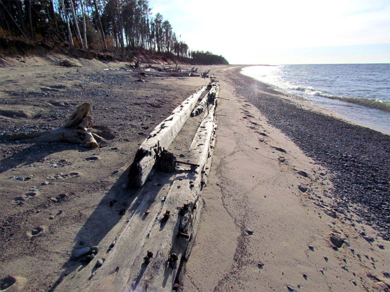
There were 3 sections of wreck exposed on the beach. The longest section is at least 100 foot in length. The C.F. Curtis propeller schooner was built in 1882 in Marine City, MI. She was 197 foot in length. The Selden E. Marvin was built in 1881 in Toledo, Ohio. She was 175 feet in length. The Annie F Peterson was built in Green Bay WI in 1874. She was 191 feet in length. It is unclear if the sections of wreckage are from one of these ships, or from multiple.

First, here is a photo of an 1871 schooner that may have resembled the ships that went down in the 1914 storm.

Here is a photo of part of the shipwreck that is now exposed on the beach ten miles east of Grand Marais.


One of the best times to hike in Grand Marais is during the spring. Every day it seems like there is a new wildflower in bloom. It is also a fun time to hike the Pictured Rocks lakeshore trail. Below is a shot of a trillium-lined trail in the Park as well as a few taken on a hike in the Chapel Rock area.


And finally one of the sunset pictures I’ve taken in the past few weeks. It is always exciting in Grand Marais the first time the sun sets east of Au Sable Point – at least from the vantage point of the town.

CUSTOMER AGATE FINDS: Fall 2010

Early this fall I had a call from Shirley Schadle. She now lives with her husband in Grand Rapids, MI, but she grew up in Zambia, Africa. Her dad was a veterinarian there, so Shirley had a chance to look for agates near Victoria Falls as well as along the Luangwa River. She visited my booth at both the Mason and East Grand Rapids shows. When I saw the Zambia agates, I was struck by three things. First of all, many of them looked just like Lake Superior agates. I have said that before about some of the agates from Botswana, China, and Mexico – but this time the similarities are even more pronounced.

Second, there were a couple of the agates that look a lot like Botswana agates with pinks and grays. When I did some research to find out more about the genesis of Zambia agates, I found out that they formed in basalt pockets from plumes of hot magma that erupted to the surface of southern Africa between 177 and 185 million years ago. This type of plume is considered by geologists to be a “large igneous province” since it spread lava over an area more than 38,610 square miles in a short geologic period. What is interesting is that this same plume produced both Zambia and Botswana agates.

Third, I noticed that some of the agates appear to be polished. When I asked Shirley if she tumbled them, she emphatically said that she had not. Apparently there was diamond dust that naturally occurred in the river. As the agate nodules tumbled down the river carried by the currents, some of them were naturally polished by this diamond sand.

Below is a Zambia agate that not only looks like a Lake Superior eye agate, but it was also naturally polished by the diamond sand in the river

The next contribution to this web page update includes agates found by Lee Dane from Vanderbilt, MI. She goes agate hunting every chance she gets, most of the time between Crisp Point and Vermillion Beach, located on the southeastern shore of Lake Superior. Lee showed me the agates during a busy art show, but I was able to snap off a few pictures.


MINERAL OF THE MONTH: Fall 2010 – Ammonite Fossil

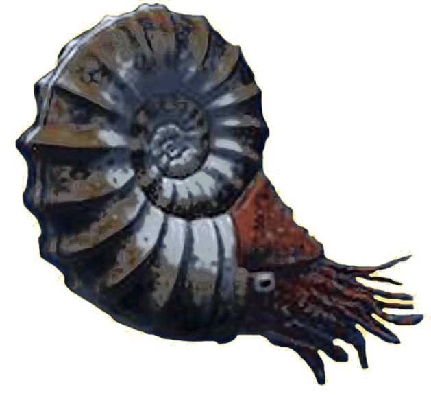
The mineral of the month is the ammonite (Ammonoid) fossil. Ammonites are an extinct group of marine invertebrate animals from the Cephalopod class. These fossilized mollusks are more closely related to living cephalopods such as octopuses and squid, than they are to the modern nautilus, which has a similarly shaped shell. Two pictures of ammonite fossils are below. I took the first photo and Tom Shearer took the other two photos (Figures 135 & 136 in the new agate book).

Ammonites are excellent index fossils. Depending on the species of ammonite found in a rock layer, geologists can specify the geologic time period for that layer.

The name ammonite was inspired by the spiral shape of the fossilized shells, which somewhat resemble tightly-coiled rams’ horns. The Egyptian god, Ammon, was typically depicted wearing rams’ horns.

Eight different orders of ammonites are known to have existed, ranging from 400 million to 65.5 million years ago. They ranged in size from a fraction of an inch to over 7 feet in diameter. After being born, they fed on plankton and quickly assumed a strong protective outer shell. They also grew quickly with the females growing up to 400 percent larger than the males because they needed the extra space for egg production.

Because ammonites are extinct, little is known about their way of life. Their soft body parts were very rarely preserved in any detail. It is thought that depending on the species, they lived in a variety of ocean environments. Some probably lived in open water, while others survived at the bottom of the ocean. It is also believed that ammonites may have avoided becoming a predator’s dinner by squirting ink, much like modern cephalopods.

The soft body of the organism occupied the largest segment of the shell at the end of the coil. The smaller sections were walled off which allowed the animal to maintain its buoyancy by either filling the chambers with gas, or emptying the sea water out of these chambers. Thus the smaller sections of the coil would have floated above the larger sections. As it grew, it added newer and larger chambers to the open end of the coil.

In medieval Europe, fossil ammonites were thought to be petrified coiled snakes. These fossils were often called “snakestones” or “serpentstones.”

History’s Gem of the Month: Reprint from the Douglas Houghton Expedition

Fall 2010

The following text was found in the Gitche Gumee Museum’s archive. There is a note attached that says it was taken from The Superior Sun (1929), which in turn took it from Geographical Reports of Douglas Houghton, published by the Michigan Historical Commission in 1928, but written in 1874 by Bela Hubbard.

“Among the pleasantest of all my reminiscences of travel is that of the exploration, in connection with the geological survey of Michigan, of the coasts of our upper peninsula in 1840.

The party for this expedition was composed of the State geologist Dr. Douglas Houghton; his two assistants, C.C. Douglas and myself, Fred Hubbard, in charge of instrumental observations; for a part of the way, H. Thielson, a civil engineer; and Charles W Penny, a young merchant from Detroit.

We left Detroit on the steamer Illinois, arriving at Mackinac on May 23rd. Here two boat crews were made up, consisting of six Canadians. These men belonged to that class so famous in the early days of the fur trade, and the French regime, now extinct, and known to history as “coureurs de bois.” They were of mixed blood, in some the French while in others the Indian predominated. Bred to the business, they would row without fatigue from daybreak until dark – twelve or fourteen hours – unload the boats, pitch the tents for the bourgeois, pile up the baggage, prepare the evening meal, and then creep silently under their blankets in the open air and enjoy the sound sleep that labor bestows.”

…”The beaches [of the southeastern shore of Lake Superior] terminate at a deep harbor called the Grand Marais. Steep cliffs are first observed rising from the water with a very uniform face, of about 200 feet in height, beyond which are visible dunes, rising still higher in the distance. On our approach the whole appeared like lofty hills enveloped in fog. This proved to be nothing less than clouds of sand which the winds were constantly sweeping toward the lake, and which formed a mist so dense as to conceal completely the real character of the coast.

On ascending these steep and wasting [sand dune] cliffs, a scene opens to view, which has no parallel except in the great deserts. For an extent of many miles nothing is visible but a waste of sand; not under the form of monotonous plain, but rising into lofty cones, sweeping in graceful curves, hurled into hollows and spread into long-extended valleys. Thrusting through the sand are several tops of half-buried pines, barkless, and worn dry and craggy by the drifting sands, while below the surface their [trunk] bodies appear to be in perfect preservation. To our imagination they seemed the time-worn columns of an antique temple, whose main structure has long ago tumbled into dust, or been buried like the ruins of Egypt, beneath the drift of many centuries.

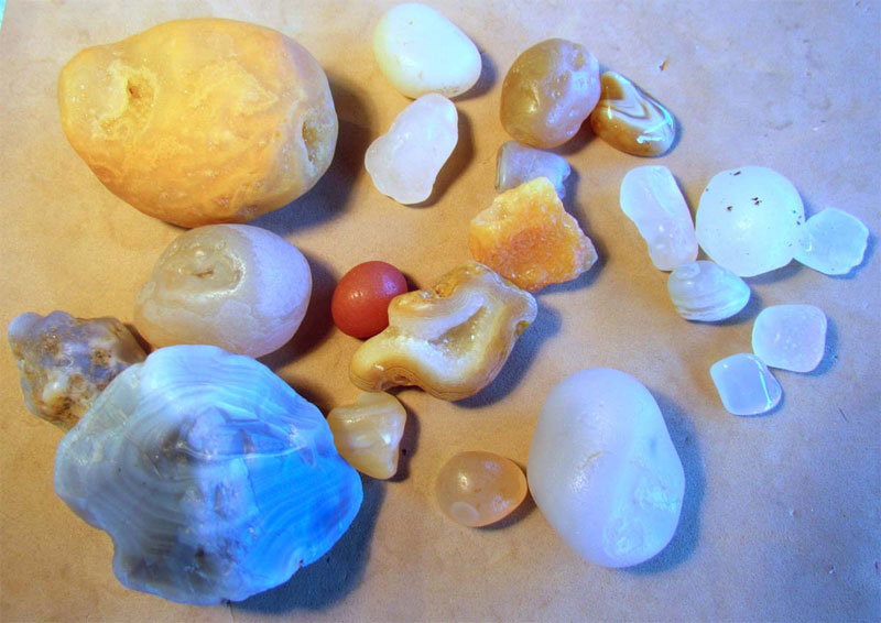
At Grand Marais the surface sand is mostly packed quite hard, and may be trod as a solid floor. This, in many places, is strewed thickly with pebbles; the deep hollows presented vast beds of them. Among these are a great variety of precious stones common to the rocks of the country – agates, chalcedony, jasper, quartz of every shade of color and transparency, with hornstone, trap, and other minerals. All are worn smooth, and often beautifully polished by the sharp, drifting sands; many rich specimens were obtained. We were reminded of the valley of diamonds in the Arabian tales, which it was the fortune of Sinbad to discover, in scarcely less singular depository.

In the rear of this desert, a small and beautiful lake lies embosomed. From the diamond lake, issues a small stream (Old Grand Sable), which after making its way through the sand, reaches the clay that constitutes the base of these dunes, and tumbles a perfect cascade into the greater lake. This rivulet separates the dense maple forest which lies on the east from the cliffs of driven sand, which rise abruptly to a height that far overlooks the woodland, and are the commencement of the Grand and leafless sables.

The view on ascending these is most entrancing. On the one side stretches beneath, and far away, the verdant forests; while by a transition as sudden as it is opposite in character, on the other side every feature of the landscape seems as if buried beneath hills of snow. The desert surface might be likened to that of an angry ocean, only that the undulations are far more vast, and the wave crests more lofty than the billows of the sea in its wildest commotion.
Looking upward from one of these immense basins, where only the sand-wave meets the sky, the beholder is impressed with a sublimity of a novel kind, unmixed with the terror which attends a storm upon the Alps, or on the ocean. The [Grand Marais area} scene, wild and unique, may well claim this brief praise– though hitherto unsung and lacking the charm of historical association—is the consecration and the poet’s dream.”