CURRENT GRAND MARAIS SCENES: July 2010

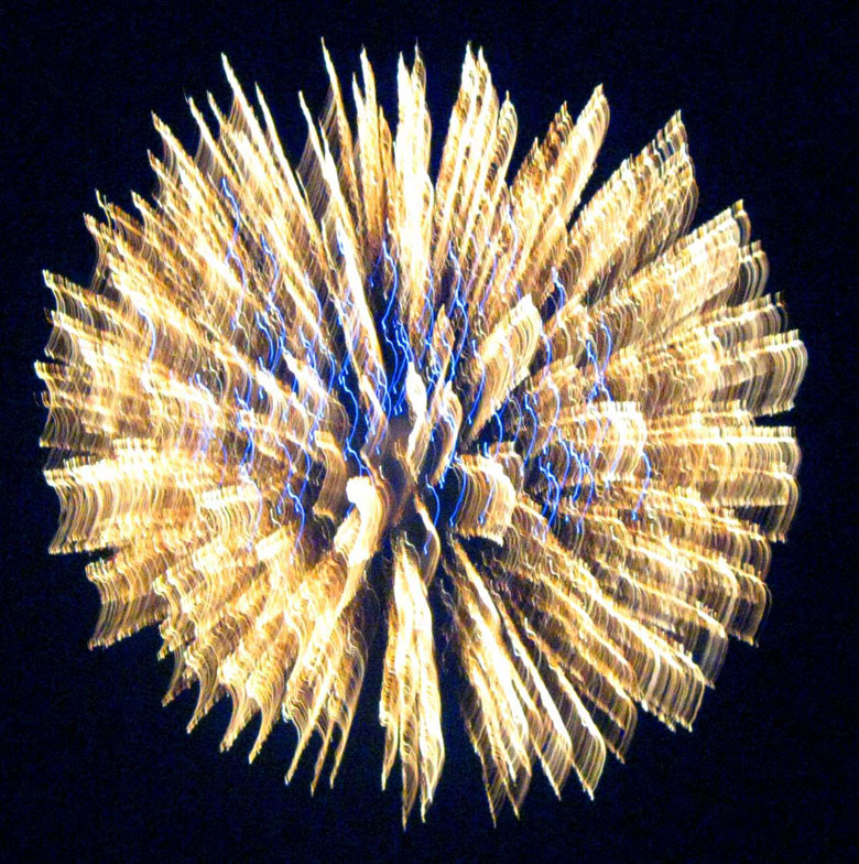
The Grand Marais July 4th celebration was fantastic this year. The weather was warm, but a good time was had by all. I enjoyed visiting with a friend, Marsha Hendrickson, as well as my aunt and uncle, Lynne and Doug Kane. It is a challenge to get the timing right, especially with digital cameras that have a built-in focus delay, but I enjoy taking pictures of the fireworks. Below is one of the shots.


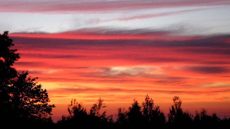
One of the advantages that we have on the south shore of Lake Superior is that we get to enjoy summer sunsets. I was home working and didn’t get down to the beach to capture the sunset over the lake, but even from my house, this fog-enhanced sunset was spectacular.

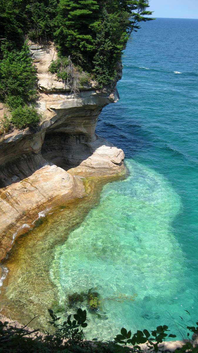
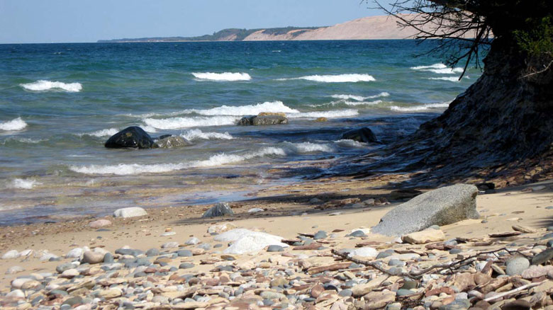
Things have been so busy lately that I have not been able to squeeze much time in for hiking. That is not a good thing since I am supposed to be training for my 15th Grand Canyon hike. I have until January, though, so there is still time. Last week I traded hours with Candace so I could have Sunday off. So hiking friend, Wendy, and I headed west and hiked the ten-mile Chapel Loop. It was a bit much since we haven’t been hiking, but we faired well and it was a beautiful day. Below are a few of the shots taken during the hike.


CURRENT GRAND MARAIS SCENES: June 2010

Since I now maintain the blog at www.agatelady.blogspot.com as well as this web page and include photos on both — I was originally going to separate photos and not duplicate. That is difficult so I’ve decided that the photos on this web page will be my favorite from those included during the previous few weeks on the blog.

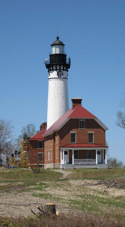
This month I am including a couple of photos taken during a hike from the Log Slide to Au Sable Lighthouse in the Pictured Rocks National Lakeshore. There is a crew of people upgrading the lighthouse complex as well as restoring it to the 1910 era. The lighthouse tower has never looked so good.


Approximately halfway on the hike, there is a bridge that allows you to climb down and gain access to the beach. This is one of my favorite spots in the Grand Marais area.


I have started training early for another Grand Canyon hike that is scheduled for next January. Here is a photo I took during a dune hike of one of the many telegraph poles that at one time connected Au Sable Lighthouse with Grand Marais.


I recently had an invitation to golf on Mackinac Island. I had the opportunity to fly over instead of taking the ferry. Although I have flown over to the island before from St. Ignace, I have never done so during the warm months. The flight provided the opportunity to get this great shot of the Mackinac Bridge.


While on the island I was able to enjoy a sunset from a friend’s property, located on the west end of the island.

CURRENT GRAND MARAIS SCENES: April/May 2010

CURRENT GRAND MARAIS SCENES

April/May 2010

Other than the day we had some snow in early May, which melted right away, it has been a beautiful spring. As is true everywhere else, the trees are leafing out, the trilliums are up, rocks are again exposed on the beach, and the days are getting longer. This transition in spring is even more dramatic in Grand Marais than it is in other areas. We especially enjoy the spring because all of the roads open up. It is great to be able to take a drive to see the beauty that is all around us.

Below are some shots that document spring in Grand Marais.


CURRENT GRAND MARAIS SCENES: April 2010

Since I update the blog www.agatelady.blogspot.com on a regular basis, I have decided that from now on any photos that I include in the regular web page update will be different than those that are included in the blog update.

Of all the snowshoe and ski adventures I have been lucky enough to participate in this winter, the best adventure took place yesterday. It was in the 40s with brilliant sunshine. Friend, Wendy Lynn, and I headed into the dunes from Sable Lake and headed northwest. Our goal was to get to the highest point in the dunes, which is at around 900 feet above sea level. The sun has been so intense lately. This combined with the warm southerly winds has caused most of the snow in the dunes to have already melted. I would estimate that the spring thaw is at least a month ahead of schedule.

The views yesterday were incredible. Here is a photo I took from one of the highest dunes looking east. You can see the channel lighthouse in the upper left of the photo. In the upper right of the photo, you can see a small section of Grand Marais Bay as well as what is left of Lonesome Point.

From the bluff around 1/3 of the way across the dunes walking east to west, you can see how the southwest winds are pushing some of the “pancake” ice back out into the lake.

At this rate of snowmelt as well as ice break up, we will have early agate picking in Grand Marais this year. That is, of course, if we don’t get a late season snow storm.

Here is one more shot that was taken from up in the dunes, looking back toward the dunes that are next to Sable Lake.

CURRENT GRAND MARAIS SCENES: February 2010

Although we have had snow cover in Grand Marais since early December, the total snowfall amount is much less than in previous years. We’ve only had one big storm, which occurred around Christmas time. In January, we have only received a few inches of snow. There is still a lot of winter left; we will have to see what Mother Nature has in store for us.

This month’s feature scenes are from some of the outdoor adventures I’ve had with friends.

The first couple of photos were taken while on a very adventurous bushwhacking cross-country ski trip in the school forest with friends Andy and Craig. I learned the hard way that it is not easy to ski in deep snow when you have skies meant for track skiing. After three falls and much effort, it was nice to see the Lake Superior beach from the vantage point east of town. The wind was definitely whipping off the lake, so we didn’t hang out at the bluff very long. Notice the beginning of the ice build-up, as well as the floating ice balls, waiting their turn to accumulate and become part of the rows of ice that hug the shore. I skied back to H58 on the snowmobile tracks, rather than bushwhacking. The second photo was taken on the trail next to the Sucker River.

A week or so after that I decided that I needed to get off my writing chair and go down to the beach; the wind had finally diminished after a couple of weeks of blowing, so museum assistant, Candace, and I snowshoed from the boardwalk in town down the beach to Sable Falls, and back. You can see from the first photo that the ice was piled on shore around ten or fifteen feet high. This shot was taken from in front of Woodland Park looking west. The next shot was taken of a teepee built on the beach by pre-winter tourists. They certainly had some time put into that project! Is anyone ready to move in? The third picture is Sable Falls. Yes, the waterfalls are hidden somewhere under all that ice.

The third week of January I went out of town with a friend, Dianna. It was a beautiful sunny day that drew us outside. In the winter, because of lake effect snow and clouds, we don’t have much of an opportunity to see the sun. We celebrated by skiing Canada Lakes in Newberry as well as Tahquamenon Falls, located north of Newberry. Below is a picture of Tahquamenon Falls, as well as a close up of some of the ice hanging from the cliffs next to the falls. The icicles in the latter picture are 70 or 80 feet long!


CURRENT GRAND MARAIS SCENES: Fall 2009

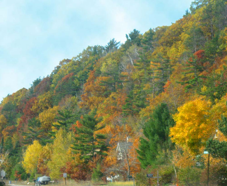
Travel has been occupying my time lately, so I have not been home enough to get out in Grand Marais very much. However, I do have a couple of fall color shots.

During my travels this past year, I have been looking for roadside Americana art. I saw two examples on my recent trip. The first is a fisherman creation in front of someone’s house.


CURRENT GRAND MARAIS SCENES: September 2009

This month’s featured photos include a mixture of scenes. First, I’ve included a few from Whitefish Point, taken last weekend when I was there with a booth and teaching agate classes. The first is a picture taken from my booth on the porch of the gift shop, looking out over the museum complex. I must admit that the number of tourists was surprising, as was the care that the historical society has taken to preserve buildings, add new structures, and present information about Great Lakes shipwrecks. If you have never visited Whitefish Point, located 11 miles north of Paradise, I highly recommend that you plan a trip.

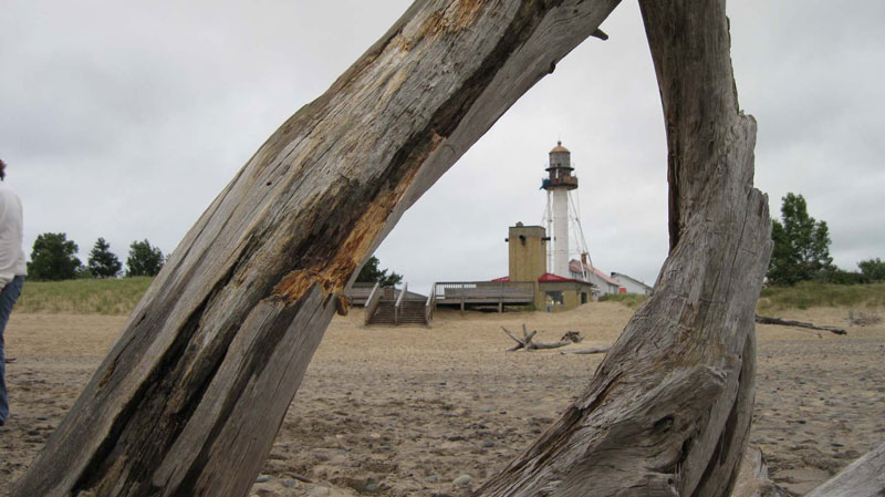
I didn’t get much of a chance to enjoy being at that location, due to the booth and the classes. However, early on Saturday morning, I did venture down the beach for a short time. The next picture was taken from the water’s edge, looking back at the lighthouse – taking advantage of an artistic piece of driftwood.

Whitefish Point had the first operating lighthouse on Lake Superior in 1849, although the current tower was erected much later. Since navigation began on Lake Superior, there have been approximately 550 wrecks, most of which occurred on the south coast. As a result, the south shore has been nicknamed “the graveyard coast.” More vessels were lost in the Whitefish Point area than any other part of Lake Superior. There are three major reasons for the high loss of ships in this area. First, the eastern end of the lake is very congested where the lake narrows down like a funnel. Up and downbound ships must pass through this fairly narrow channel-like bay. Second, poor vis

ility from the fog, forest fires, and snow caused numerous collisions and groundings in this narrow, congested bay. Finally, over 200 miles of open water with predominant northwest winds can build up terrific seas during storms, making navigation into Whitefish Bay quite a challenge.

Collisions were more common in earlier times because there were more vessels, and, of course, none of the modern navigational technologies. In the 1880s over 3,100 commercial vessels traveled Lake Superior, compared to less than 200 today. Since the first known shipwreck of a commercial vessel, The Invincible, in November 1816 to the Edmund Fitzgerald on November 10, 1975, approximately 320 lives have been lost along the Graveyard Coast. Below is a photo of makeshift memorial markers for 3 of the 29 crew members lost during the wreck of the Edmund Fitzgerald. I’ve also included a photo of a passing ore freighter to illustrate how close to shore the vessels must travel to get into or pass out of Whitefish Bay.

After returning home and working the museum one-day last week, my friend Renee Beaver and I went camping east of town. Pictured below are our cooking fire and the view we had of Lake Superior. Later that night, a fantastic lightning storm moved from southwest to northeast over the lake. Although we had hoped for Northern Lights, which have been nonexistent this year, we were satisfied with the incredible lightning show.

CURRENT GRAND MARAIS SCENES: August 2009

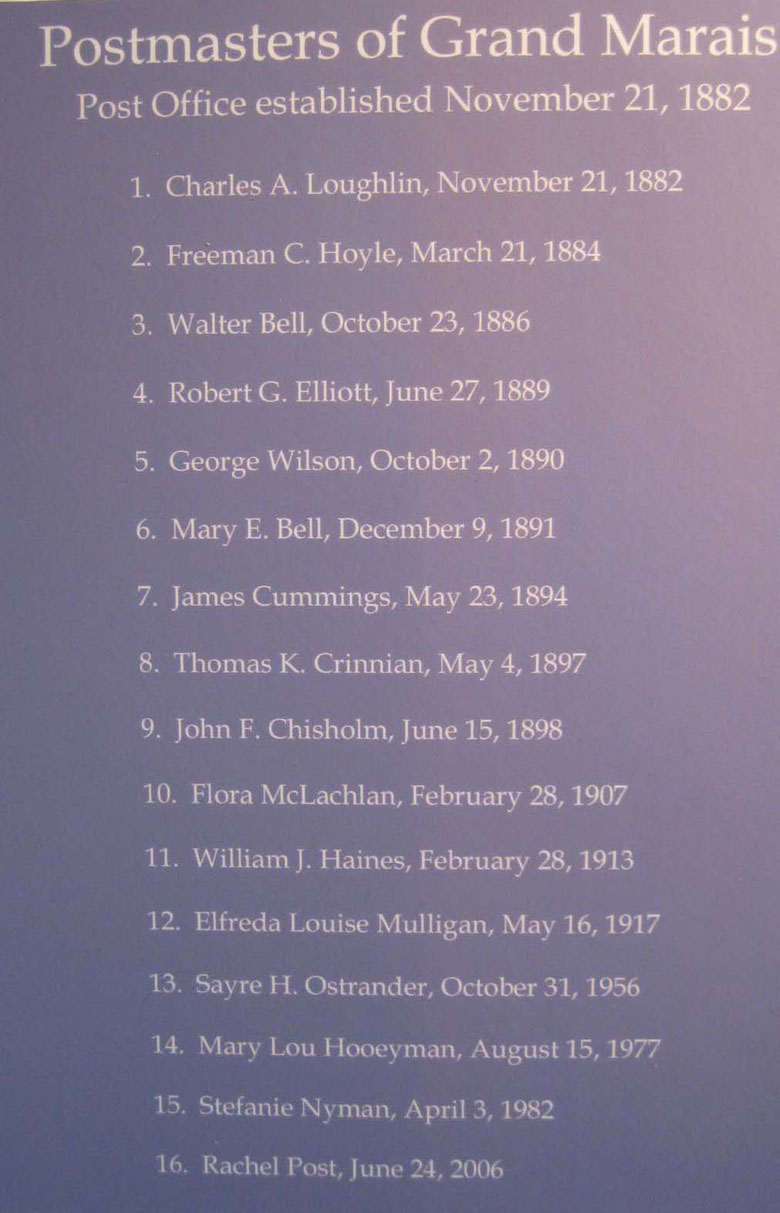
On July 25th there was a lot happening in Grand Marais. At noon, the historical society had a ribbon-cutting ceremony for the new Post Office Museum. This unique 5-sided building served as the Grand Marais post office for many decades. The building was moved from its original site to Main Street last year and has now been restored. Grand Marais has had a post office since 1882. The front section honors the postmasters who have served Grand Marais, including Elfreda Mulligan who served for 40 years, beginning in 1917. Although it has not been definitely proven, the historical society reports that she may have been the longest serving postmaster in the country.

The rear of the post office has been turned into a historical display, with information and graphics describing the history of Grand Marais.

I would like to congratulate the historical society for a job well done!

CURRENT GRAND MARAIS SCENES: July 2009

Unfortunately, my busy schedule has not allowed me time to go hiking this past week. However, before that, we were able to hike in the dunes many a day. The bugs have been a bit of a challenge on some of the days, but bug shirts and bug hats allow us to be outside and still enjoy the scenery.


On the day that the above photo was taken, we walked north on the Masse Homestead Trail (half way between Sable Lake and the Logslide). We needed our spring hiking outfits while walking in the woods. There is a good access spot to get up into the dunes around a 12-minute hike down the trail. Once in the dunes, we were able to take our bug gear off.

We then headed west to the Logslide, where we stopped and had lunch, and rested. Finally, we walked back to our car down the Masse trail. It was a beautiful day to hike!


The next photo was taken when my friend, Kim, and I went to Marquette. She had never been to the Michigan Nature Association property in Munising, located across from Sand Point. This is a picture of Memorial Falls. I just love the area, with its grottos and peaceful waterfalls.


Although they have slowed down a bit now that flowers are in bloom and it is warmer (after an incredibly cold spring), the hummingbirds are still active. For a while, it seemed like 10 or 12 hummingbirds were fighting for the feeders all day long. I have never seen so many hummingbirds. In fact, there were so many battling it out for the feeder, that my cats were afraid of them!


CURRENT GRAND MARAIS SCENES: Spring 2009

When I left for my trips in late April, it was still winter in Grand Marais in that there were still five-foot snowbanks in my yard. When I arrived home two weeks later – the snow was melted, the flowers were beginning to bloom, and the trees were budding out.

I’ll include a few of my favorite pictures in this update. However, if you want to see more photos, please go to my blog at www.agatelady.blogspot.com.

Although this is a standard “tourist” photo, it was so beautiful yesterday with the waves wrapping around Au Sable Point, that I had to take this shot and include it.


On the same 10 mile hike yesterday down the Masse Homestead trail from H58 West to the Log Slide, and then to the lighthouse and back, I also took a photo documenting the beginning spring wildflowers, as well as a shot on the beach near the rustic campground on Au Sable Point.

On the same 10 mile hike yesterday down the Masse Homestead trail from H58 West to the Log Slide, and then to the lighthouse and back, I also took a photo documenting the beginning spring wildflowers, as well as a shot on the beach near the rustic campground on Au Sable Point.


Finally, I took this sunset photo while on Mackinaw Island the end of April.

Finally, I took this sunset photo while on Mackinaw Island the end of April.