Since the regular museum hours ended in September, I have spent all my free time when not at shows working on the Online Rockhounding Adventures. Thus, I have not executed a web page update. So for this update, I’ll include a few extra photos.
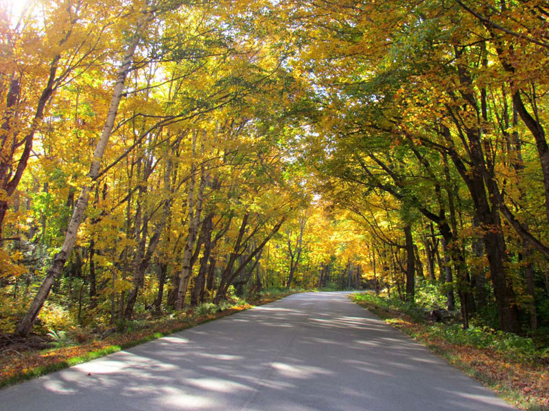
Fall colors were spectacular last autumn. Some of the maple trees were redder than they have been in years.
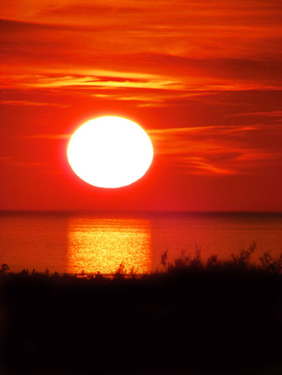
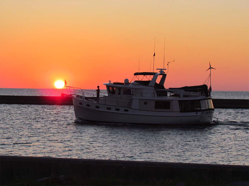
Even during the part of the year that the sun sets south of Au Sable Point, we still have nice beach sunsets.
I must admit that the summer schedule did not allow much time to hike. This is the first year that I worked most of the hours, other than when I was away at shows. The blog keeps me honest, to a degree, so I was able to get some good shots to document the beauty of the Grand Marais, MI area.
Twice this summer I hiked from the Hurricane River to Au Sable lighthouse. It is a great section of beach that is dotted with shipwreck remnants.
The lighthouse was built in the late 1800s to warn passing ships of the sandstone rock that extends a mile out from shore. The view from the top is amazing.
Progress on the new break wall, which will protect the mouth of Grand Marais bay, continues.
The waves of Lake Superior usually do not kick up their heels until October or November. These past few years, however, we have had strong winds much earlier. This year we had two extreme wind events in August!
Summer is the time when we in Grand Marais enjoy some fantastic sunsets. In the winter, the sun sets too far south.
I have been busier than normal the past few months, but I still make time to get out to hike and take pictures. I cannot afford the time daily, but I try to get out a few times a week.
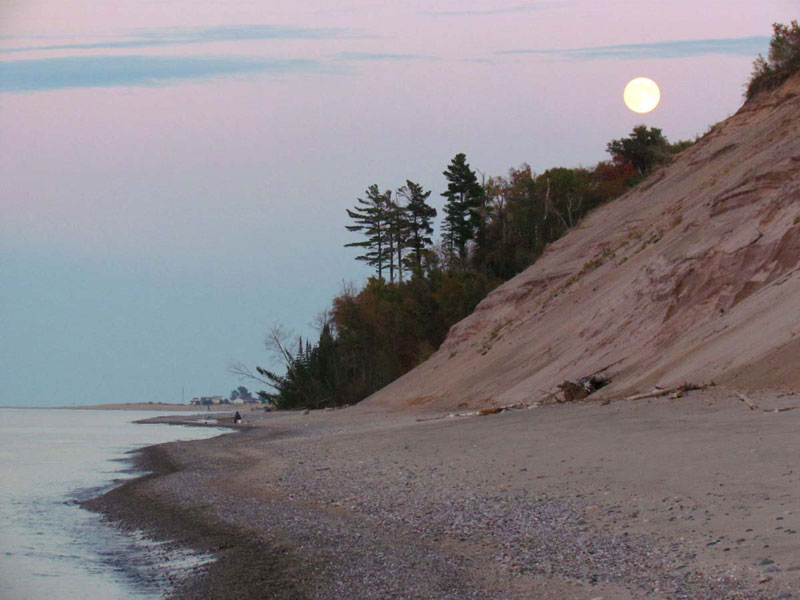
For this web page update, I am including a variety of pictures from the Grand Marais area. First, here are a couple pictures taken from the bluff of the Grand Sable Dunes.
During one sunset hike in the dunes, an ore freighter was passing by.
Here is a picture that was taken of one of the ghost forests in the Grand Sable Dunes.
My friends, Gerald and Jill, bought a house located near Carpenter Creek on the east side of town. I have never walked up that creek bed to see the grotto waterfalls – at least until a week or so ago. I just love falls that tumble over grotto walk formations.
On Memorial Day weekend I walked out the channel break wall to get pictures of the sunset. I have never seen so many people. There were more than 100 people enjoying the beautiful evening. This is VERY rare for Grand Marais.
The wildflowers have been terrific again this year. I especially enjoyed the trilliums.
One of the best parts of spending time in Grand Marais is to enjoy sunsets on the shore of Lake Superior.
Things have been busy in Grand Marais relevant to the building of the new break wall. I am in favor of making sure that our bay will serve as a harbor of refuge. This certainly requires protecting the mouth of the bay. I just wish that they would spend the extra money and build the break wall to follow the shoreline, rather than dissect the bay. The area east and northeast of the new break wall will fill in with sand. Plus there could be other unforeseen consequences. Let’s keep our fingers crossed that these are minimal.
This seemingly has been the winter that wasn’t. Sure we have had cold temperatures, but for the second year in a row, I did not register any readings at my house below zero. The coldest my thermometer read was around 2 degrees F. During most of the winter the high temperatures were in the 20s and 30s. This week in mid-March we have seen temperatures in the 60s. Until the beginning of March, we didn’t even really have a full blown snow storm. In that storm, we received almost two feet of snow. I just called the County Road Commission and found out that the snowfall total in Grand Marais this winter has only been 148 inches. This measurement is taken south of town in the lake-effect snow belt, so in town, the total is much less. The contact person at the county thinks this may the lowest annual snowfall total ever recorded in Grand Marais.
Despite the mild temperatures, I have still captured some worthy winter scenes. But first is the picture I took of the March full moon. This shot was captured at the end of Coast Guard Point in Grand Marais. OK. I’ll admit it. This image is actually two photos merged together. The actual rising moon is much smaller relative to the pancake ice floating in the channel. It is still a cool image.
The next image was taken from the bluff on the bay looking east toward the harbor lighthouse. It features interesting colors from the sunset.
The next photo I took from Sand Point in Munising, MI. It is a picture of the ice hanging down from the cliffs on Grand Island.
The next two pictures are late-winter beach photos showing some of the shore ice.
These next two photos I took in front of the museum of UP 200 dog sled race teams. Because of lack of snow race officials had to change the route. Instead of starting and ending in Marquette, this year the mushers made two round trips between Chatham and Grand Marais, finishing for the first time on Sunday in Grand Marais.
Although the one winter storm we had was fierce, I bundled up and headed for the beach where I captured this next shot of shore ice.
The last two pictures I took while snowshoeing near the School Forest east of town right after the winter storm. Everything seemed to be covered in snow.
Winter has been slow to start up in the Grand Marais area. There are no official snowfall totals for Grand Marais, but there are for Marquette. We are down at least 30 inches of snow so far this winter. Only half of the ski runs are open at Marquette Mountain. Many of the snowmobile trails are barely usable – some are not. I cross country skied the Grand Marais trails today. Although they have been groomed, grass and twigs show through on the track. The lack of snow is not only a problem here but throughout the country. Only 22 percent of the nation was covered by snow on January 4th. Compared to the last decade or so, it is the smallest area of snow cover. The second smallest total for this date was in 2007 at 27 percent of the country.
The national map showing snow cover as of January 4th is below.
Since I have not executed a web page update for a while, I’ll include some fall as well as a few early winter photos. If you would like to enjoy additional photos, please go to my photo journal blog at www.agatelady.blogspot.com.
When they started paving H58 between Grand Marais and Munising, some locals were upset that we would lose the tree canopy covering the road. The section just west of Grand Marais was paved several years ago. The canopy has now recovered.
Although winter has not kicked in with its full power, I still have a few photos. Normally shots like these would have been taken in October. These were all taken in December and January. The first shot was taken from a beach located around six miles east of Grand Marais.
During the late fall, the waves of Lake Superior throw the large trees scattered on the beach like they are toothpicks. Then, as the temperature drops, the water can freeze on the branches and roots making some artistic displays.
This picture was taken when I was walking back from Au Sable Lighthouse to the Log Slide.
Sable Lake has frozen late this year. Here is a picture of the ice starting to form in late December.
On one of the calmer fall days, I headed down the beach to see if I could capture the full moon. The adventure was a success.
This has been the year of wind. It seems like once a week or so we end up with a major wind event. Here is a shot I took in October of the waves hitting the break wall and lighthouse in Grand Marais.
This picture was taken from just east of the Log Slide (7 miles west of Grand Marais) in the Pictured Rocks National Lakeshore.
It was difficult to select pictures to feature in this update’s current Grand Marais scenes. If you would like to see others that I did not select, please visit my photoblog at www.agatelady.blogspot.com.
We’ll start out with a shot I took the day before the full lunar eclipse, which happened on December 21st. I posted some of the photos on the blog of the actual eclipse, but I like the full moon shot the best.
The UP 200 dog sled race took place the weekend of February 19th. The event has been going on for over 20 years. The race is limited to 40 dog sled teams, although only 19 teams signed up this year. Mushers included 8 from Minnesota, 4 from Michigan, 3 from Wisconsin, 2 from North Dakota, 1 from Ontario, and 1 from Ohio. Three women participated this year. In addition to the UP 200, there was also an 89-mile midnight run race with a route from Gwinn to Deerton and then ending in Munising.
The UP 200 route starts in the Marquette area traveling east to Grand Marais and back — usually a 240-mile round-trip distance. Because of the icy conditions, race officials shortened the race this year to end in Wetmore, which is located just east of Munising.
I did decide to open the museum this year, which took some work since I had to unpack all the items from the last art show plus the things I purchased in Tucson. It worked out well so I’m glad I decided to heat the building and open. The starting gate for the mushers to continue the return trip of the race is located right in front of the museum.
Fourteen of the teams finished this year’s race. Ryan Anderson from Ray, MN finished first as Team 2 with a total time of 21:42:24. He finished with 11 dogs, averaged 13.2 mph and had 10:34 rest time. Nathan Schroeder from Chisholm, MN finished second as team 4 with a total time of 22:00:29. David Gill as Team 13 finished third with a time of 22:21:37.
The event is possible because of hundreds of volunteers at each of the checkpoints, as well as the race officials, trail maintenance crew, timers, team runners (to help the teams get to the starting lines), and members of the community who work the trail to held direct the teams at intersections and at major turns in the trail.
Although we certainly are still in the midst of winter here on the south shore of Lake Superior, it has been the third winter in a row with lower than average snowfall amounts. I talked with one of the local road commission workers the other day who told me that the official snow amount received in the Grand Marais area so far this year is 170 inches. They measure the snowfall amounts several miles south of town. A few years ago we had over 325 inches of snow.
Below are a few winter shots taken in the Grand Marais area. First, a photo was taken from First Creek located just west of Woodland Park. Notice the remnants of a snowmobile track. For those who are not aware, it is illegal to drive any motorized vehicles including snowmobiles on the beach.
Here is a picture I took from the beach on the south side of Grand Marais Bay looking north toward the end of Coast Guard Point.
I have continued snowshoeing in the dunes this winter. Here is a picture that was taken from the Ghost Forest area near Sable Falls. When the wind breaks up the ice, many times the smaller chunks form into floating pancake ice. Also, notice the iceberg “blow hole” in the center of the picture. It is not safe to walk on the icebergs since sometimes you cannot see the blowholes as they may be covered over with snow.
During a recent thaw, we had alternating freezing and thawing temperatures. These changing temperatures can add to the beauty of the ice formations.
It was difficult to select the photos I want to feature in this update. I must admit that I love taking pictures with my camera and because I have taken so many pictures these past few months (since the last web page update), I have thousands from which to choose. During the summer months, it is especially fun to take pictures of sunrises and sunsets. This is the only time of the year that the sun rises and sets far enough north that we can see it out over the lake from Grand Marais. I don’t get down to the lakeside to take many shots of sunrises, but in early August I couldn’t sleep early one beautiful morning and I headed down to the breakwater at the end of coast guard point. Just as I pulled up next to the Lighthouse Keeper’s museum, a fishing boat was heading through the channel out into Lake Superior.
I have had almost no time this summer to agate hunt along the local beaches. One evening I did head east of town and squeezed in a few minutes walking along the rocks.
There are many sunset pictures in my archive from this summer, but here are a few of my favorites. The first one shows the sun setting over coast guard point. The second one shows the afterglow of sunset in the background (pink sky) and a couple of the sailboats in Grand Marais bay in the foreground.
I had two opportunities to capture couples enjoying sunsets. The first was taken at 12 Mile beach campground and the second was taken on a beach located just west of Munising. Notice Grand Island in the background.
We have had several storms this past month, many of which resulted in huge waves pounding the shore. Here are a couple of shots taken along the Mosquito-Chapel Loop hiking trail in the Pictured Rocks National Lakeshore. Some of the splashes from the waves were blasting more than 100 feet in the air! The second picture below was taken on the back side of Grand Portal Point away from the wind.
Here is yet another picture showing waves plummeting the breakwater and lighthouse in Grand Marais.
It was again difficult to select pictures to feature in this update’s current Grand Marais scenes. Since I update the photoblog almost daily at www.agatelady.blogspot.com, there are a lot from which to choose. I decided to select pictures that capture the diversity of what you can see in the Grand Marais area if you are willing to get out and explore.
We’ll start out with some photos documenting the end of winter and beginning of spring. This is when the snow and ice begin to melt. Because sand is mixed in with the frozen precipitation, there are beautiful color schemes that develop during the melting phase. The first picture shows ice in the channel entering Grand Marais Bay. Shore ice hugging and extending from the beach is shown in the second photo. The tall structures in the third picture look like dunes, but they are actually 20-30 foot icebergs anchored right offshore. A storm the next day after I took this picture in early April broke apart the ice.
As many of you know, my favorite place to hike in the local area is the Grand Sable Dunes. This fantastic geologic formation contains some the world’s most pristine perched dunes. They cover a five-mile stretch of the Sable River and Au Sable point. Glacial ice that melted within the Superior Basin around 10,000 years ago produced many large rivers. These rivers deposited millions of tons of debris into many different configurations south of the Superior Basin. The Grand Sable Banks most likely originated along one of these glacial rivers.
Around 8,500 years ago, the Pictured Rocks area then became very dry when the Lake Superior basin changed its drainage pattern and began emptying to the north from its east end when this new outlet was the low spot. A north facing bluff formed and remained in place for 4,500 years right around the Grand Marais area.
Between 4,000 and 6,000 years ago, the landmass that is now the Upper Peninsula started to rebound upward from the weight of the previous ice glacier. This is called isocratic rebound. The U.P. is still rebounding today. The land forming the lake’s outlet at North Bay began to rise, which reduced the amount of outflow and caused water levels to rise rapidly. In fact, Lake Superior rose to about 40 feet higher than it is today! The rise in lake levels formed Lake Nipissing. Lake levels of Lake Nipissing also began to rise which caused the Grand Sable Banks to become unstable. The higher water eroded the bluffs which left them exposed to wind. A dominant northwesterly wind blew through the Grand Sable Banks which carried the wind from the bluff to the top of the flat upland. This sand was “perched” on top of the upland, hence the name, “perched dune system.”
The climate of the Grand Sable Dunes is typical of any Michigan climate. The winters are fairly long and cold while the summers are short and cool. The location of the dunes happens to be the second most cloudy area of the United States. The average cloud cover is approximately 70%. Grand Marais’ annual temperature is 40.8 degrees Fahrenheit with precipitation totaling 31 inches a year. During the winter season, snowfall accumulation ranges from 130 to over 200 inches. Because the dunes are so close to Lake Superior extreme low temperatures in the winter and extremely high temperatures in the summer do not occur.
If you plan on taking the hike to the Grand Sable Dunes the best way to get there would be to take the trail that starts at the west end of the Sable Falls parking area. While on the trail you will walk through an old field and eventually cross over a bridge that runs about Sable Creek. For the next ¼ mile you will go through the forests and dune transition areas. Along the trail, stop and take a look at the wayside exhibits. Another way to access the dunes is through the north country trail while is located ¼ mile east of the log slide.
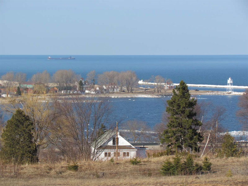
To the west of the dunes is Au Sable Point. Here is a shot of the point and the Au Sable Lighthouse from the south side of the dunes.We have had quite a few freighters pass by Grand Marais as of late. Here is a shot from the hill south of town that shows a freighter passing by Grand Marais Bay.
A hundred years ago and more the south shore of Lake Superior was known as the Grave Yard Coast. Many schooners (which were the ship of choice back then) were taken out by the storms of Lake Superior. I did some research this morning to find out more about the shipwrecks. There were three ships that went down in a storm on November 19, 1914. Here are some articles about the wrecks:
Seney, Mich., Nov. 21. — Life savers reported today that a total of 12 bodies have been found on the south shore of Lake Superior during the 35 hours’ search which followed the fearful gale that swept the lake Thursday. The four bodies found since the searchers previously reported were all of men. The two corpses of women have been unidentified. Among the wreckage cast ashore today were several life belts stenciled “Steamer Curtis.” As no trace of the steamer C. F. Curtis was been obtained and as it is considered certain that one of her schooners, the Annie M. Peterson, sank near Grand Marais, local marine men believe the Curtis also went to the bottom. It is also claimed there were only seven persons on board the Peterson. The Curtis was known to have been to wing the schooners Peterson and S. E. Marvin when the gale struck her. No wreckage of the Marvin has been found so far as searchers in this vicinity have been able to learn.
Sault Ste. Marie, Mich., Nov. 21. — Up to a late hour today, the last 24 hours had revealed little information to clear up the mystery surrounding the fate of the steamer C. F. Curtis and the lumber laden schooners S. E. Marvin and Annie M. Peterson in tow of the Curtis, which were caught Thursday in the season’s most severe storm on Lake Superior. That the Peterson went down in “the grave yard of the Great Lakes” near Grand Marais, seems absolutely certain in view of her bodies and wreckage which have been washed ashore. Two of the eight bodies recovered last night were identified today as members of the Peterson’s crew. Whether some of the other bodies were from the Curtis or Marvin remained to be determined after identification had been made. The three missing vessels carried 26 persons in their combined crews. The fact that two of the bodies recovered were those of unidentified women caused many to believe the Curtis met the same fate as the Peterson inasmuch as it was thought one or both of women had been employed on that vessel. The sailing records did not reveal any women hands on the two schooners. The three ships cleared from Baraga with lumber for North Tonawanda, N.Y. Wednesday morning. They should have passed this port long ago, but were not heard from until the Peterson wreckage was found yesterday. None of the several other steamers which went aground along the upper lakes during the gale was seriously damaged according to reports today.
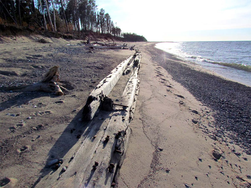
There were 3 sections of wreck exposed on the beach. The longest section is at least 100 foot in length. The C.F. Curtis propeller schooner was built in 1882 in Marine City, MI. She was 197 foot in length. The Selden E. Marvin was built in 1881 in Toledo, Ohio. She was 175 feet in length. The Annie F Peterson was built in Green Bay WI in 1874. She was 191 feet in length. It is unclear if the sections of wreckage are from one of these ships, or from multiple.
First, here is a photo of an 1871 schooner that may have resembled the ships that went down in the 1914 storm.Here is a photo of part of the shipwreck that is now exposed on the beach ten miles east of Grand Marais.
One of the best times to hike in Grand Marais is during the spring. Every day it seems like there is a new wildflower in bloom. It is also a fun time to hike the Pictured Rocks lakeshore trail. Below is a shot of a trillium-lined trail in the Park as well as a few taken on a hike in the Chapel Rock area.
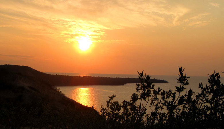
And finally one of the sunset pictures I’ve taken in the past few weeks. It is always exciting in Grand Marais the first time the sun sets east of Au Sable Point – at least from the vantage point of the town.
This has been an incredibly windy fall. The winds started Labor Day weekend and have continued off and on (but mostly on) for four months. In the Grand Marais area, we have had a few storms with wind speeds over 60 mph; one storm clocked winds at 84 mph!
We also have had a fairly normal start to the winter. In Grand Marais, we only have around ten inches of snow on the ground as of mid-December. There are areas south and west of town that have well over two feet! Due to the blowing and drifting, there are also several areas in the local woods and in the dunes with drifts that are several feet high.
The photos featured this month in Grand Marais Scenes start with a couple of fall pictures. Each September for the past ten years my sister, Diana, has visited from Holland, MI. We decided several years ago to explore the Upper Peninsula so that we can hike and take pictures. This year we rented a cabin and spent a couple of days having adventures in the Porcupine Mountains. What a treat! We happened to hit peak fall colors and also enjoyed spectacular weather. Here is a shot I took on a hiking trail that overlooks Lake of the Clouds.
In between shows during the few days this fall I was home, hiking friend Wendy and I were able to venture out a couple of times. Before the snow started, we hiked the Chapel Loop in the Pictured Rocks National Lakeshore. This is around a nine-mile hike that takes you past Chapel Falls, Chapel Rock, Mosquito Beach, and Mosquito Falls. A couple of pictures taken during this hike are below. The first shows the fall colors on the trail to Chapel Falls.
The next picture was taken of the cliffs located at the base of Grand Portal Point.
Wendy and I also hiked from the Log Slide to Au Sable Lighthouse a few times. Below is a picture of the lighthouse as well as one taken on the beach just east of the lighthouse.
NOTE: If you are interested in seeing more pictures of the Grand Marais, MI area, please visit my blog at www.agatelady.blogspot.com. I am not exactly sure what a blog is supposed to be. I use mine as a photo journal.
We went from a hot August to a cool and windy September. My busy schedule has not allowed time for a lot of hikes. However, I was able to snap off a few pictures while visiting friends around town.
Since I didn’t have time to implement an August update, I’ll include pictures in this update from both August and September. Let’s start with a picture from this year’s Grand Marais Music and Arts Festival. We locals really appreciated Al Young returning to the stage – this time featuring his son, Nolan, on the saxophone.
There were several spectacular sunset photos from which to choose. I decided I like this picture taken while hiking in the dunes.
Many of the storms that have rolled through Grand Marais this past month have moved quickly. When that happens, sometimes you end up with a rainbow on the back end of the storm. In August, we were treated to a double rainbow over the bay. The rainbow appeared just before sunset, so the low sun angle gave us a special treat in terms of the rainbow’s quality. Thanks to Andy Mitchell for supplying the full-rainbow shot that my point-and-shoot digital camera could not capture.
Friend, Wendy, and I have hiked west from the Log Slide a couple of times lately. Here are two shots that were taken from the beach located under the footbridge around ¾ of the way down the trail. Both shots feature Jacobsville sandstone, which is the oldest sandstone in the park. It was formed during the pre-Cambrian period around a billion years ago. It is known for its multi-colored nature featuring iron-red staining. The stone has been quarried in places throughout the Upper Peninsula and has been used to make many buildings.
The storms have created some great picture taking opportunities. While at Whitefish Point in August, I captured the black clouds behind some of the museum’s buildings. Also, the waves have been intense before, during, and after the storms. On September 3rd while I was in Charlevoix at an art show, winds were clocked in Grand Marais as high as 72 mph! From what I have heard, waves were as high as 15 feet with some perhaps as high as 20 feet.