CURRENT GRAND MARAIS SCENES: March 2009

Although I have enjoyed cross-country skiing and snowshoeing this winter, I must admit that I am ready for spring. Even though spring officially has begun, we still have a lot of snow in the woods. The warmer temperatures have made the deep snow slushy, so we have been hiking and snowshoeing in the dunes for exercise. I would like to thank my new exercise partners, Kathy and Steve Correll, for several great hikes these past few weeks.

The images below were taken during some of these dunes hikes. The first photo was taken from the Grand Sable Dunes bluff in the Ghost Forest, which is near Sable Falls. The second picture of Sable River was taken while hiking from the Sable Visitor’s Center to the Ghost Forest.

A few days after these pictures were taken, Grand Marais experienced a huge spring storm with winds well over 60 mph. Unfortunately, the resulting waves broke up many of the icebergs. I was hoping that the bergs would reform to create even higher structures, but it doesn’t look like that is going to happen. The storm also knocked down hundreds of trees and branches. On a snowshoe yesterday from the Sable Visitor’s Center to the Ghost Forest, we had to step over a lot of downed trees. I must admit that the forest looked like a destruction zone.

The three shots below were taken during some of the dune hikes, near Sable Lake.

The last image featured this month was taken while I drove back to Grand Marais from the Escanaba art show last Sunday. My friend, Renee Beaver Stocking, went with me to the show to help out. We decided to take a different route home and drive through Trenary. When we stopped for dinner, Renee noticed the cat sitting on the old fire truck. I would like to thank Renee for her help at the show. Set up and tear down go a lot faster with two people. I would also like to thank her brother, Kevin Beaver and his wife Martha, for letting us stay at their house over the weekend.

CURRENT GRAND MARAIS SCENES: February 2009

On this second to last day in February, it is another one of those old-fashioned winter blustery days. We received another foot of snow last night so the season’s total now exceeds 250 inches. Since the wind chill is well below zero, to document some of the snow I decided to just drive out to Coast Guard Point. For those of you who have homes out there and have not arranged for snow plowing, if you want to visit your home you may want to call ahead to have someone unbury it. Below are a few shots of some of the buildings out on the point.

Last month I included a photo taken of the southwest side of my house where the snow drifted over my woodshed, which is attached to my garage. Below is a shot taken from inside my sun porch, looking west at the center portion of my home. Note that the bottom of the red-trimmed windows is over 7 feet off the ground.
The last photo featured this month is one that I took from the top of the bluff at Hilltop Cabins the day after I arrived back from my trip out west. It shows that the bay in Grand Marais is frozen along with the area along the shore.

CURRENT GRAND MARAIS SCENES: January 2009

This has certainly been a winter for many people around the country, Grand Marais included. I have lived here since 1994 and this is the most snow I’ve seen for this time of year. As of about a week ago, our official total was almost 180 inches! It has also been a cold winter, although Grand Marais has not been as cold as some other areas in the U.P. This morning we were around 5 below with a wind chill of 30 below! Other communities were nearly 30 below ambient! Lake Superior is still not frozen very far out – only around a ¼ to ½ mile from shore. The good news is that the warmer waters buffer our temperature. The bad news to some, other than us skiers, is that the difference in temperature (warm lake vs. cold land) creates almost daily lake effect snow.

All of the pictures this month, of course, feature the snow. The first is a shot I took on one of the very few sunny days we have had this winter. It is a picture of the Sucker River in the School Forest. Most of the river is frozen, at least on top. However, the current is swifter in a few places to enable these terrific, high-contract photos.


While in the school forest last week skiing with my friend, Dianna Bell (Bayshore Market), we skied all the way to Goebel Beach. As you rockhounds can see in the next photo looking east from Goebel, there are no rocks to be seen. This is the first time this winter I’ve skied to the lakeshore through the school forest. I was hoping there would be BIG ice bergs, which there were not. There is a lot of float ice, though, that will pile up and form into giant ice bergs if we get a stiff wind from the north.


When I cross country ski with my friends, we usually ski the trails in the national park. These trails and those in the school forest each have their pluses and minuses. The PRNL trails are groomed more frequently, have a wider array of ecosystems, are straighter so you can ski faster, and have more hills. For me, they are also convenient since they are located only a ½ mile from my house. The school forest trails wind along the Sucker River, through expansive fantasy-like pine forests, and with bushwhacking on the snowmobile tracks allow access to the beach east of town. The picture included here was taken from Trail E in the national park, which is located above Sable Falls.


The last picture featured this month was snapped on the south side of my house during a January 17th snow storm. Because my house is located on the top of a glacial terrace hill, the snow blows up the hill and over the roof to deposit on the south side. You can see that the snow on the roof was actually connecting with the ground. The size and length of the “tunnel” of snow covering my house was growing each and every day. Finally, I had to purchase a snow rake and pull the more than 5 feet of snow off my roof. Now the drifts behind my house are even taller – between 10 and 12 feet high covering more than half of the south-side windows!


CURRENT GRAND MARAIS SCENES: December 2008

Winter has come early this year to many areas — including Grand Marais. Since my house sits up on a glacial hill, it is at the mercy of the wind all winter long. The wind piles the snow on the south side of the house. It usually takes all winter for the snow to pile 7 feet up to my kitchen window. Guess what? It is already there! The rain we had this week did not condense or melt the snow much. Plus we received another few inches today and have more forecast for every day this week. On the level, I have around two feet of snow in my yard — but there are drifts everywhere! It is a good thing that the snowplow company I hire for the season to keep my driveway open has a front-end loader!

The first two pictures I took just before Christmas. I cross-country skied and then took my skies off at the top of Sable Falls steps. It is always a challenge to descend the steps in the winter, but well worth the scenery. As many of you will recognize, these pictures were taken at the bottom of Sable Creek. The shots document the beginning formation of icebergs, looking both west and east.

The next two pictures show winter paths. The first was taken on the path next to Sable Falls. The second was taken on my ski trail path behind my house. While I was down state for Christmas, the snow piled up too much to ski. Thus, I was out snowshoeing this afternoon to pack down the snow so that I can ski tonight by headlamp.


CURRENT GRAND MARAIS SCENES: November 2008

Fall is an unbelievable time in the Upper Peninsula. The temperatures this past month or so have varied from 75 to 20 degrees. The winter season has begun, though, with a snow storm that dropped over 20 inches in some places. In Grand Marais proper, we received around 8 inches so far. As usual, the lake effect machine dropped most of its load south of town.

All of the pictures featured this month were taken before the snow. There will be plenty of time in the next few months to document the winter scenery.

The first few pictures were taken on a couple of trips I took to the Keewenaw and Minnesota to go agate hunting. Those of you who come to Grand Marais to enjoy our beaches are somewhat spoiled. Although I like all of Lake Superior’s beaches, there are not many that offer the wide expanses of sand, rocks, and driftwood as is true in the Grand Marais area.

Included are a couple of shots of beaches elsewhere. The first was taken on Presque Isle in Marquette. I absolutely love the lava rock and enjoy imagining what it would have been like to see the molten flows inching toward Lake Superior. The second shot was taken on the north shore around 20 miles north of Duluth. You can see that both of these areas essentially have no sand at the shoreline.

Gooseberry Falls

While on the north shore, I spent a little time hiking at Gooseberry Falls. What a rugged and beautiful landscape this Minnesota state park offers.

Before the snow started, I took a few last hikes in the dunes. The first shot was taken on the path that skirts the base of the dunes on the Masse Homestead path. This path is located half way between Sable Lake and the Log Slide where the little pull out/parking area is on H58 west. I love the way that the yellows play in this photo between the ferns and the trees. From this path, there are a couple of places you can access the dunes. I did so and walked across to the lake. I’ve included a picture of one of the gravel beds on top of the bluff. It was from one of these gravel beds that the museum founder’s 5.5 pound agate tumbled down the Grand Sable Banks for Axel to find in 1958.


CURRENT GRAND MARAIS SCENES: October 2008

One of my favorite times to hike in the Upper Peninsula is during the fall season. Not only do the arboreal colors add to the splendor, but there are usually no other hikers and no bugs.

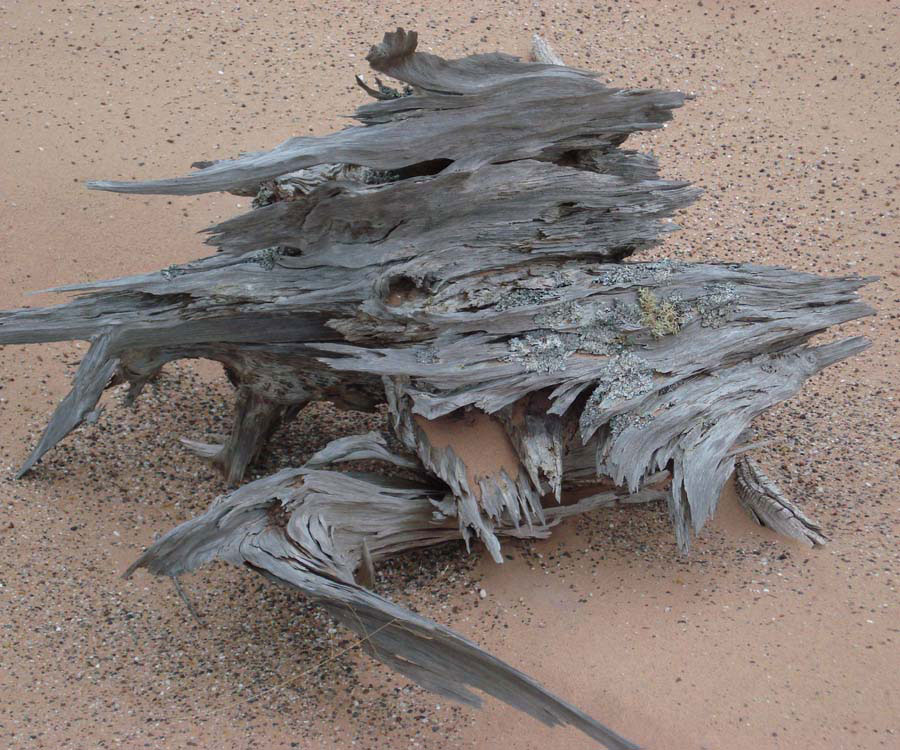
The first picture featured this month is a Ghost Forest stump. The interpretive sign near Sable Falls’ dune walk speaks about the Ghost Forest. The forest that used to be near that sign is almost disintegrated due to weather and tourists taking souvenir pieces. Thankfully, there are several other Ghost Forests sprinkled throughout the dunes. This is an amazing stump now exposed but previously protected by the sand for several thousand years.

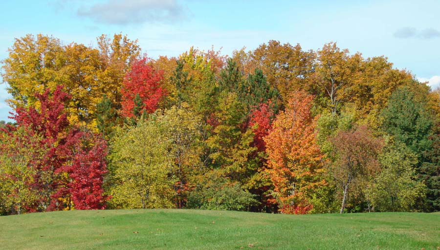
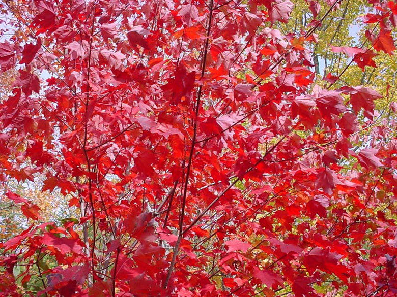
Although I included a fall picture last month, I have to also include the photo below. For what ever reason, the fall colors this year were significantly better than they have been in other years.

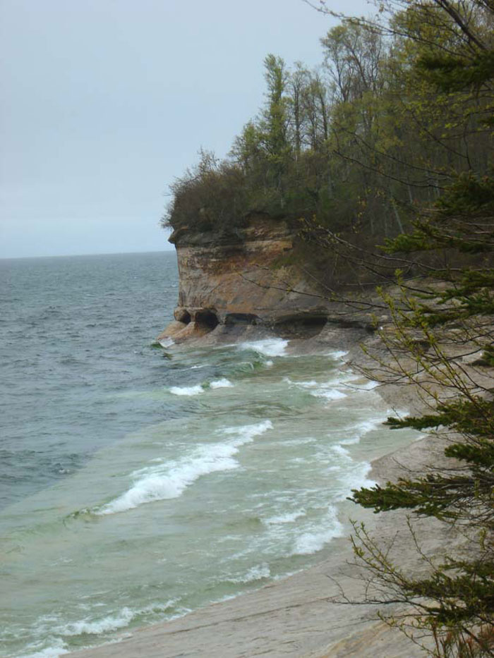
While attending the first annual agate festival held at Muskellunge State Park, I took an extra day to go agate hunting with my friend, Renee Beaver, at Vermillion Beach. I had never been to that beach before, which is located west of Whitefish Point. It is unusual and different from Grand Marais’ beaches in that the entire beach is covered in a cobblestone-like fashion with flat rocks. The type of rock is similar to that found in Grand Marais, but there are also a large number of golden-colored microcrystaline specimens — some of which that have water-level type banding.

There is also a lifesaving station at this site. This station, along with 3 others at Crisp Point, Deer Park, and the Two-Hearted, were constructed in 1876. Vermillion was known as Station #9, and was opened on May 15, 1877. The station housed the keeper and his family, a crew of 6 to 8 surf men, supplies, life-saving equipment, and guests. The purpose of these stations, of course, was to render assistance to ships in distress and save the lives of sailors on those ships. Even though the southern shore of Lake Superior is known as the “graveyard coast,” these life saving stations were responsible for saving hundreds of lives.

In 1888, the state’s largest cranberry farm was established in the marshes behind the station. A small town grew in the area and included its own post office and school. The station remained active, but was acquired by the U.S. Coast Guard in 1915. It became a Coast Guard station in 1939 and was operated until 1945. After decades of abandonment and abuse, as well as theft from vandals and souvenir hunters, the property and more than a mile of beach was purchased in the early 1970s by Evan Nayes. Nayes and the Wildshore Foundation spent years and considerable effort to restore the facility. During this time, and continuing in the 1980s, Lake Superior State University used the facility to conduct research and classes about history and ecology in this fabulous lake-side setting. The Whitefish Bird Observatory has also used the facility in recent years. In February 2007, the Little Traverse Conservancy purchased the property. They hope that this incredible place will continue to provide solace, knowledge, and awe for many generations to come.

CURRENT GRAND MARAIS SCENES: September 2008

Although September has still been busy with shows and custom orders, I have continued to hike in the dunes as much as possible. The goal this hiking season is to walk on all of the ridges in the dunes and with the hike yesterday, that goal has been completed. Next year, I want to try to walk and follow the original telegraph line from Grand Marais to Au Sable Lighthouse. In my various hikes, I have seen dozens of telegraph poles: some of which are still standing. Most of them, however, have fallen after more than a hundred years of blowing and shifting sand. Below are a couple of pictures of two of the poles I found yesterday as well as a shot of Au Sable Point taken from the middle of the dunes.

Depending on where you are in the U.P., fall colors are really starting to pop. There seems to be a lot of red this year. Below are a couple of shots taken of and near Taquanamon Falls. For those of you who have not been there, it is located an hour an a half east of Grand Marais.


CURRENT GRAND MARAIS SCENES: Summer 2008

The weather so far this summer in Grand Marais has been like what I remember it was when I was a kid. Unlike last summer with the searing 90 degree days, the temperatures have been in the 70s during the day and 50s at night. Wonderful! Since there has been enough but not too much rain, this has been the year of wild flowers. Everywhere you go, including the sand dunes, there are wild flowers. Pictured below are a couple of pictures to document some of these botanical surprises, as well as a sunset picture taken from the dunes.

The July 4th holiday was another old-fashioned celebration. I decided to take the year off from walking/riding in the parade with the 1895 bear coat — something I do every few years so I can see the parade myself. Pictured below are a few shots I took during the parade and fireworks. There were a few extra boats in the bay as well as kayaks (not pictured) who watched the fireworks from the water. The theme for the parade this year was: “Save the Grand Marais Bay.”


CURRENT GRAND MARAIS SCENES: June 2008

This month has delivered almost every type of weather. We have had temperatures range from the 30s to nearly 90. Despite the variation, though, I have kept up my exercise program and have spent a lot of time hiking in the dunes. While hiking, I took this picture of a downhill skier skiing down the Grand Sable Banks. Although it seems scary, the friction of the sand really allowed the skier to keep complete control. It is a long hike back up, though, carrying the heavy skies and ski boots!


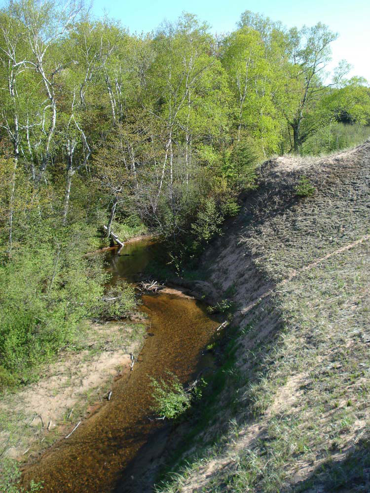
My goal by the end of the summer is to stand on every ridge in the Grand Sable Dunes. While hiking, I’ve discovered many interesting scenes. The picture below was taken from a high dune overlooking Sable Creek.


I also discovered that there are multiple “Ghost Forests.” These trees are uncovered when the wind blows and shifts the sand dunes. I hope that people who are lucky enough to come across these trees respects them and do not break them apart or take any of the pieces. Many of the uncovered trees are thousands of years old.


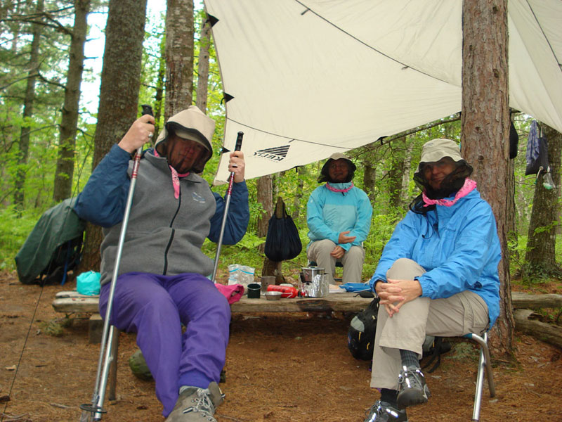
In June, I backpacked into Chapel to spend some time with friends. Here is a picture of the three of us outfitted for the elements. When the wind is from the south, it is sometimes necessary to arm yourself against the bugs. Thanks to Marsha Hendrickson and Denise Reitz for feeding me some wonderful meals at Chapel!


CURRENT GRAND MARAIS SCENES: May 2008

This month’s Grand Marais Scenes feature photos that were taken while I’ve been on my daily exercise hikes. The first photo was taken from up in Grand Sable Dunes. It shows an interesting angle of the dunes with the breakwater in Grand Marais in the distance. The second picture shows my friend, Scott Wieting, as we were walking back after the long dune trek, after which we climbed down the Grand Sable Banks and returned via the beach. Notice all of the rock on the beach.

The next two photos were taken on Memorial Day. My friend, Kim Amthor, and I left Grand Marais around 10:30 am and drove through Melstrand to the Chapel Parking Area. Our plan was to hike the “Chapel Loop,” which we successfully accomplished. In Grand Marais, it was 64 degrees when we left. The first picture was taken not long after we hiked past Chapel Rock heading west toward Mosquito Beach. During the next hour or so after taking this picture, the temperature dropped around 26 degrees and the wind increased to more than 30mph. I must admit that I didn’t bring any gloves and had to share the pair Kim brought so that my fingers were warm enough to properly operate my camera. The second picture was taken at Mosquito Beach after the cold front moved through. The moral of the story is that whenever you are hiking on the Lake Superior shoreline, you must be prepared for almost anything. Yet again, I learned this lesson the hard way!